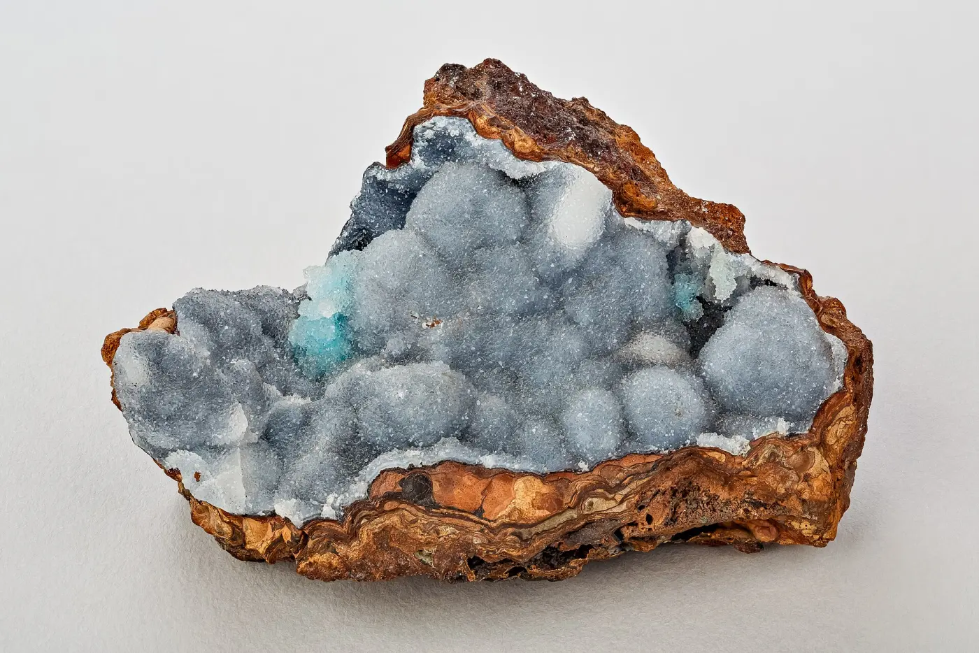
Walker Valley Geode Site
Rockhounding site in Mount Vernon, Washington · Geodes
Walker Valley Geode Site is a geode rockhounding site near Mount Vernon, WA. Fee required. Best season: Late spring through early autumn.
Typical season: Late spring through early autumn
About Walker Valley Geode Site
Walker Valley sits east of Mount Vernon in Skagit County and is one of the very few places in western Washington where the public can dig geodes for free on state land. The Washington Department of Natural Resources manages the area, and the geode ground sits within the Walker Valley ORV recreation area, which is what most of the official signage and management information is about.
The geodes occur in weathered, altered volcanic rock and heavy clay rather than in hard outcrop, which means this is a digging site rather than a hammering one. Nodules run small, commonly golf ball to fist sized, with quartz, chalcedony and sometimes calcite linings, and a significant proportion are solid rather than hollow.
The honest picture is that Walker Valley has been collected hard for decades. The surface and shallow material is long gone, and finding a productive pocket now takes committed digging in unpleasant ground. Collectors who do well here describe working one hole properly rather than sampling a dozen. Collectors who leave frustrated usually describe wandering and scratching at the surface, which is a reliable way to find nothing.
Key facts
Structured details for trip planning — verify access and fees with the land manager before you visit.
- Specimen type
- Geode
- Primary specimens
- Quartz Geodes, Chalcedony, Calcite, Agate
- Fee status
- Fee required
- Nearest town
- Mount Vernon
- State
- Washington
- Coordinates
- 48.31200, -121.97800
- Best season
- Late spring through early autumn. The site is wet, muddy and leech-ridden for much of the Washington year
- Access difficulty
- Moderate to difficult. The dig area is uphill from the trailhead, the ground is heavy clay, and finding productive pockets takes persistence
- Parking
- See facilities notes
- Collecting hazards
- Access restrictions
- Camping
- No camping. Walker Valley is day use only and dispersed camping is not permitted
- Land manager
- U.S. Forest Service
- Activities
- Digging clay and altered volcanic rock for geodes and nodules
- Facilities
- Trailhead parking only. Mount Vernon and Arlington have full services
- Last updated
- 2026-10-11
What to pack for Walker Valley Geode Site
Gear we compare for geodes trips like this one — tools, safety, and the hike in.


Disclosure: Gear links may earn a commission as an Amazon Associate — at no extra cost to you. Learn more.
The experience
- Best time to visitLate spring through early autumn. The site is wet, muddy and leech-ridden for much of the Washington year
- AccessModerate to difficult. The dig area is uphill from the trailhead, the ground is heavy clay, and finding productive pockets takes persistence
- FacilitiesTrailhead parking only. Mount Vernon and Arlington have full services
- Camping nearbyNo camping. Walker Valley is day use only and dispersed camping is not permitted
Highlights & features
- One of the few free public geode digs in western Washington
- Managed by the Washington Department of Natural Resources within the Walker Valley ORV area
- Quartz-lined geodes and chalcedony nodules occur in altered volcanic rock
- Close to Interstate 5, so it is an easy day trip from Seattle or Bellingham
- 36 miles of trails in the wider recreation area for anyone combining collecting with riding or hiking
- The geodes sit in weathered volcanic breccia and clay rather than in hard outcrop, so digging beats hammering
- Nodules are often small, in the golf ball to fist range, and many are solid rather than hollow
- Decades of collecting mean the easy ground is worked out, and productive pockets now require digging depth
How to get there
An important current note: access via the southern portion of Peter Burns Road is closed, and all access to the Walker Valley area must come from the northern portion of Peter Burns Road. Routing apps may still suggest the southern approach. The roads are paved to gravel and fine for a passenger car. The site is about an hour and a quarter from Seattle and 40 minutes from Bellingham, which is a large part of its appeal.
From Interstate 5 take exit 227 and head east on State Route 538 for about 4 miles, then turn south on State Route 9 and continue roughly 3 miles to milepost 42. Turn left on Walker Valley Road for 2 miles, then right onto Peter Burns Road and continue about 1 mile to the trailhead.
Plan your visit
Bring a Discover Pass. It is required on all street-legal vehicles parked here, including motorcycles and 4x4s, and it is the single most common reason people get a ticket at a Washington DNR site.
Bring a mattock or grub hoe, a shovel, a pry bar, a five-gallon bucket, gloves, waterproof boots, knee protection and a change of clothes. The ground is heavy clay and everything ends up coated. A short-handled sledge is useful for testing nodules in the field.
Timing: late spring through early autumn. Facilities: trailhead parking only.
The area is day use only, with no dispersed camping, so plan a single day and stay on designated trails and roads. Pick one promising spot, dig it properly, and be prepared for the possibility of an empty day; that is the realistic expectation at a site this heavily worked. Combine with other Washington collecting areas.
Things you need to take to Walker Valley Geode Site

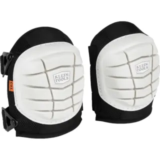
NoCry Professional Construction Knee Pads
Buy once — your knees will notice by lunch.
Check price on Amazon
DEWALT DPG82 Concealer Safety Glasses
Buy two pairs — one lives in your pack permanently.
Check price on Amazon
Osborn 8-Piece Wire & Nylon Brush Set
The standard field brush kit — keep one in every pack.
Check price on Amazon
Osprey Talon 22 Backpack
The pack to save for if you collect more than a few times a year.
Check price on AmazonDisclosure: Gear links may earn a commission as an Amazon Associate — at no extra cost to you. Learn more.
Access & fees
Walker Valley is Washington Department of Natural Resources land within the Walker Valley ORV recreation area, and DNR's rules for the area govern your visit. A Discover Pass is required on all street-legal vehicles, including motorcycles and 4x4s. The area is day use only, with no dispersed camping permitted. Visitors must stay on designated trails, obey posted signs, avoid closed trails and pack out all rubbish. Current access alert: the southern portion of Peter Burns Road is closed, and all access must come from the northern portion. Washington DNR's general position on collecting is that each landowner sets its own rules, and the geode pit has historically been open to public hobby collecting. Because ORV area management can change and specific pits can be closed for safety, check current DNR information for Walker Valley before travelling, or call the area contacts on 564-243-9154 or 360-854-8687. Keep collecting to hand tools and personal quantities, and fill your holes.
Walker Valley is Washington Department of Natural Resources land within the Walker Valley ORV recreation area, and DNR's rules for the area govern your visit.
A Discover Pass is required on all street-legal vehicles, including motorcycles and 4x4s. The area is day use only, with no dispersed camping permitted. Visitors must stay on designated trails, obey posted signs, avoid closed trails and pack out all rubbish.
Current access alert: the southern portion of Peter Burns Road is closed, and all access must come from the northern portion.
Washington DNR's general position on collecting is that each landowner sets its own rules, and the geode pit has historically been open to public hobby collecting. Because ORV area management can change and specific pits can be closed for safety, check current DNR information for Walker Valley before travelling, or call the area contacts on 564-243-9154 or 360-854-8687. Keep collecting to hand tools and personal quantities, and fill your holes.
Frequently asked questions
Do you need a pass to dig geodes at Walker Valley?
Yes. A Discover Pass is required on all street-legal vehicles parked at Walker Valley, including motorcycles and 4x4s, because it is Washington Department of Natural Resources land. Collecting itself is free, but the parking pass is enforced and is the most common reason visitors get ticketed.
How do you get to the Walker Valley geode site?
From Interstate 5 exit 227, go east on SR 538 for 4 miles, south on SR 9 for 3 miles to milepost 42, left on Walker Valley Road for 2 miles, then right on Peter Burns Road for about 1 mile. Important: the southern portion of Peter Burns Road is closed, so all access must come from the northern portion.
Is Walker Valley still open for geode collecting?
The geode ground has historically been open to public hobby collecting on Washington DNR land, and the area remains a managed recreation site. Because ORV area management changes and individual pits can be closed for safety, check current DNR information or call 564-243-9154 before travelling.
What tools do you need at Walker Valley?
A mattock or grub hoe and a shovel for the heavy clay, a pry bar, a five-gallon bucket, gloves, waterproof boots, knee protection and a change of clothes. A short-handled sledge helps test whether a nodule rings hollow. This is a digging site rather than a hammering one, so weight of tools matters less than leverage.
Can you camp at Walker Valley?
No. Walker Valley is day use only and dispersed camping is not permitted anywhere in the area. Plan a single day trip, which is easy given that the site is about an hour and a quarter from Seattle and 40 minutes from Bellingham.
Are there still geodes at Walker Valley?
Yes, but the site has been collected hard for decades and the easy material is gone. Productive pockets now require committed digging in heavy clay rather than surface searching. Collectors who report good results describe working one hole properly; those who leave empty-handed usually describe wandering and scratching at the surface.
How big are Walker Valley geodes?
Most run small, commonly golf ball to fist sized, with quartz, chalcedony and sometimes calcite linings. A significant proportion turn out solid rather than hollow. Expect to open several nodules before finding a good crystal-lined cavity, which is normal for the deposit rather than a sign you are in the wrong spot.
Where else can you dig geodes in Washington?
Options are limited in the west of the state, which is part of why Walker Valley draws so many visitors. East of the Cascades, the Teanaway and Kittitas County country produces agate and geode material, and Red Top Mountain in the Wenatchee National Forest is a well-known agate locality. Rules differ by land manager, so check each one.
Is Walker Valley safe with the ORV traffic?
It is manageable with awareness. The area carries 36 miles of trails used by motorcycles, ATVs and 4x4s, and collectors share road sections with them. Stay on designated routes, park clear of trail entrances, wear something visible, and keep children close on any shared surface.
What is the best season for Walker Valley?
Late spring through early autumn. Western Washington clay is miserable when wet, which is most of the year, and pits fill with water. A stretch of dry weather makes the digging far more productive and the walk in far less slippery, so time a visit to a dry spell rather than to a date.
Why do so many people come away from Walker Valley with nothing?
This is the most common complaint about the site, and the explanation collectors give is consistent: the shallow material was worked out long ago, so anyone scanning the surface or scratching a few inches down is searching ground that has already been searched many times. The people who report finding geodes describe committing to one hole, digging properly into undisturbed clay, and accepting that this is slow, dirty work. Walking a wide area looking for something obvious is the approach that reliably produces an empty bucket here.
Is the geode pit at Walker Valley still legally open?
Collectors asking this generally get the same answer: the pit itself has remained open to public hobby collecting on DNR land, and the thing that catches people out is the Discover Pass rather than any collecting restriction. The practical advice given is to hang the pass before you walk away from the vehicle, use the northern Peter Burns Road access since the southern portion is closed, and check current DNR information before a long drive, because ORV area management does change.
Explore related hubs
Report an access change
Field conditions change. If this site is closed, claimed, flooded, or the fee has changed, tell us — we update listings with community tips and desk verification.
Include the date you visited and any land-manager contact. Do not share private gate codes.
Map & location
Culture & history
Walker Valley's geodes have been known to Pacific Northwest rockhounding clubs since the mid-twentieth century, and the site appears in generations of regional field guides. That long history is exactly why the easy material is gone. The wider valley is working forest land in the Cascade foothills, logged and replanted in cycles, and its current identity as an off-road vehicle recreation area reflects a broader pattern on Washington DNR trust lands, where timber production, motorised recreation and dispersed uses like rock collecting share the same ground.
Conservation
This is shared multi-use land, and collectors are one user group among several. Fill every hole you dig, both because open pits in clay are a hazard on ground used by motorcycles and 4x4s and because it is the condition of continued access. Stay on designated trails and roads, park where signage allows, and display your Discover Pass. Do not create new pits where you can work existing ones. Pack out all rubbish, including other people's, since this site collects litter. Report unsafe pits or damage to the DNR area contacts rather than working around them.
Sources & updates
Official land managers cited on this page
Always confirm current rules, closures, and fees on the agency site before visiting.
Spotted outdated access, fees, or safety info? Use Report an access change on this page or send a correction with the page URL — we review every submission.