Cumberland Plateau Geode Beds
Rockhounding site in Livingston, Tennessee · Geodes
Cumberland Plateau Geode Beds is a geode rockhounding site near Livingston, TN. Fee varies. Best season: Late autumn through early spring.
Typical season: Late autumn through early spring
About Cumberland Plateau Geode Beds
The Upper Cumberland region of Tennessee, roughly the country around Livingston, Jamestown and Crossville on and below the Cumberland Plateau escarpment, is the state's recognised geode ground. Geodes weather out of Mississippian carbonate units, principally in the Fort Payne and equivalent formations, and accumulate in creek beds, draws and road cuts along the escarpment and its drainages.
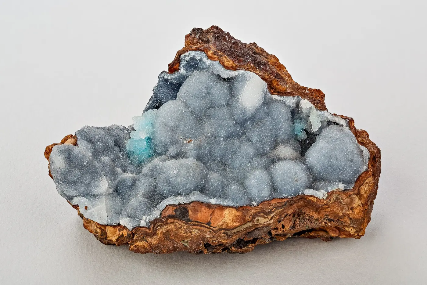
The formation mechanism differs from the volcanic geodes of the western states. Here the cavities developed in limestone and dolomite, and dolomitizing fluids moving through the rock are the leading explanation for how they formed. That chemistry shows in the linings, which run to quartz and calcite rather than to amethyst and chalcedony, with celestite as a distinctive regional accessory and marcasite and dolomite also present.
Practically, this is surface collecting rather than quarrying. Creeks do the work of freeing geodes from soft carbonate and concentrating them in gravel, so a walk down a plateau creek in low water is far more productive than digging. The constraint, as across most of Tennessee, is that nearly all of this ground is private, and access is a matter of asking.
Key facts
Structured details for trip planning — verify access and fees with the land manager before you visit.
- Specimen type
- Geode
- Primary specimens
- Quartz Geodes, Calcite, Celestite, Dolomite, Marcasite
- Fee status
- Fee varies
- Nearest town
- Livingston
- State
- Tennessee
- Coordinates
- 36.38000, -85.32000
- Best season
- Late autumn through early spring. Low water exposes creek beds, and leaf-off conditions make cut banks and road cuts visible
- Access difficulty
- Moderate. Creek walking on slick limestone cobbles, plus steep, brushy approaches down the plateau escarpment
- Collecting hazards
- Flood / current risk
- Camping
- State parks and private campgrounds operate across the Cumberland Plateau, though collecting is not permitted in Tennessee state parks
- Activities
- Surface searching creek beds and weathered exposures for geodes, where permission has been arranged
- Facilities
- None in the field. Livingston, Crossville, Jamestown and Cookeville have full services
- Last updated
- 2026-09-15
What to pack for Cumberland Plateau Geode Beds
Gear we compare for geodes trips like this one — tools, safety, and the hike in.


Disclosure: Gear links may earn a commission as an Amazon Associate — at no extra cost to you. Learn more.
The experience
- Best time to visitLate autumn through early spring. Low water exposes creek beds, and leaf-off conditions make cut banks and road cuts visible
- AccessModerate. Creek walking on slick limestone cobbles, plus steep, brushy approaches down the plateau escarpment
- FacilitiesNone in the field. Livingston, Crossville, Jamestown and Cookeville have full services
- Camping nearbyState parks and private campgrounds operate across the Cumberland Plateau, though collecting is not permitted in Tennessee state parks
Highlights & features
- The Upper Cumberland is Tennessee's recognised geode country, centred on the Livingston and Crossville area
- Geodes weather out of Mississippian carbonate units along the plateau escarpment and its drainages
- Interiors are typically lined with quartz and calcite, with celestite reported from the region
- Creek beds concentrate weathered geodes, so surface searching outperforms digging
- Close to the Fort Payne Formation outcrop belt that produces geodes through Tennessee and Kentucky
- Geodes here form in carbonate host rock rather than in volcanic cavities, which is why the linings run to calcite and quartz
- Dolomitizing fluids are the leading explanation for geode formation in Fort Payne age rock across the region
- The Cumberland Plateau escarpment exposes a thick section, so a short walk crosses several units
How to get there
The Upper Cumberland is reached from Interstate 40 between Cookeville and Crossville, with Tennessee Highway 111 and US Highway 127 running north into Overton, Fentress and Pickett counties. Livingston is the seat of Overton County, Jamestown of Fentress County, and Crossville sits on the plateau on Interstate 40. The Boatland area in the Fentress and Overton county country is among the localities noted in regional collecting literature. Highways are paved and easy. County and gravel roads run down the escarpment into the creek drainages and can be steep, narrow and rutted, with limited turnarounds. Get a county plat or ownership map before you go; it is the tool that actually determines where you can collect.
The Upper Cumberland is reached from Interstate 40 between Cookeville and Crossville, with Tennessee Highway 111 and US Highway 127 running north into Overton, Fentress and Pickett counties.
Livingston is the seat of Overton County, Jamestown of Fentress County, and Crossville sits on the plateau on Interstate 40. The Boatland area in the Fentress and Overton county country is among the localities noted in regional collecting literature.
Highways are paved and easy. County and gravel roads run down the escarpment into the creek drainages and can be steep, narrow and rutted, with limited turnarounds. Get a county plat or ownership map before you go; it is the tool that actually determines where you can collect.
Plan your visit
Plan a half to full day, and plan the access before the date.
Bring a bucket, a small pry bar, boots you can wade in, gloves, a hand lens and a short-handled sledge for testing whether a nodule rings hollow. Polarised sunglasses help in shallow creek water. Newspaper protects opened halves on the way home.
Timing: late autumn through early spring, at low water. Facilities: none in the field; services in Livingston, Crossville, Jamestown and Cookeville.
Work creek gravel, the base of cut banks and the aprons below weathered road cuts, looking for the rough, roughly spherical nodules that stand out from bedded limestone cobbles. Tennessee state parks do not permit collecting, so use them for camping and interpretation rather than as sites. The Cooper Gem Mine and other fee digs in Tennessee offer a permission-free alternative, and the region connects to other Tennessee collecting areas.
Things you need to take to Cumberland Plateau Geode Beds

NoCry Professional Construction Knee Pads
Buy once — your knees will notice by lunch.
Check price on Amazon
DEWALT DPG82 Concealer Safety Glasses
Buy two pairs — one lives in your pack permanently.
Check price on Amazon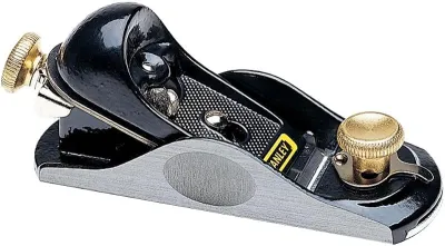
Osborn 8-Piece Wire & Nylon Brush Set
The standard field brush kit — keep one in every pack.
Check price on Amazon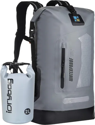
Osprey Talon 22 Backpack
The pack to save for if you collect more than a few times a year.
Check price on AmazonDisclosure: Gear links may earn a commission as an Amazon Associate — at no extra cost to you. Learn more.
Access & fees
There is no general public geode bed in the Upper Cumberland, and that shapes every trip. Productive ground is overwhelmingly private farm, pasture and timber land. Collecting requires the landowner's permission, including in creek beds, since in Tennessee the streambed on private land is generally private. Pulling off a county road to walk down to a creek is trespass without it. Ask specifically, agree where you may park and what you may take, and stick to it. Tennessee state parks prohibit rock and mineral collecting, so they are viewing and camping destinations rather than sites. Road cuts are highway right of way; stopping on them is generally prohibited and working a cut face is unsafe regardless of the law. Where you have permission, keep to surface collecting in creek gravel and weathered float. Digging into banks on these steep plateau drainages accelerates erosion and can run into state water-quality rules. Close gates, avoid livestock, and pack out everything.
There is no general public geode bed in the Upper Cumberland, and that shapes every trip. Productive ground is overwhelmingly private farm, pasture and timber land.
Collecting requires the landowner's permission, including in creek beds, since in Tennessee the streambed on private land is generally private. Pulling off a county road to walk down to a creek is trespass without it. Ask specifically, agree where you may park and what you may take, and stick to it.
Tennessee state parks prohibit rock and mineral collecting, so they are viewing and camping destinations rather than sites. Road cuts are highway right of way; stopping on them is generally prohibited and working a cut face is unsafe regardless of the law.
Where you have permission, keep to surface collecting in creek gravel and weathered float. Digging into banks on these steep plateau drainages accelerates erosion and can run into state water-quality rules. Close gates, avoid livestock, and pack out everything.
Frequently asked questions
Where are geodes found in Tennessee?
Mainly in the Upper Cumberland region, around Livingston, Jamestown and Crossville on and below the Cumberland Plateau escarpment, in Overton, Fentress and neighbouring counties. They weather out of Mississippian carbonates, principally Fort Payne age rock, into creek beds, draws and road cut aprons.
Can you collect geodes on the Cumberland Plateau without permission?
No. Nearly all productive ground is private farm, pasture and timber land, and in Tennessee the streambed on private land is generally private too. Landowner permission is required, and Tennessee state parks prohibit collecting entirely.
What is inside a Cumberland Plateau geode?
Typically quartz and calcite linings, with celestite reported as a distinctive regional accessory and marcasite and dolomite also present. Because these geodes formed in carbonate host rock rather than volcanic cavities, the mineralogy differs from the amethyst and chalcedony of western geodes.
When is the best time to hunt Tennessee geodes?
Late autumn through early spring. Low water exposes creek beds where geodes concentrate, and leaf-off conditions make cut banks and road cut aprons visible. Summer brings dense vegetation, snakes and flash flood risk in the plateau drainages.
How do you tell a geode from an ordinary rock in a creek?
Look for a roughly spherical, knobbly nodule that stands out from the flat bedded limestone cobbles around it. A light tap with a short-handled sledge often tells you whether it rings hollow. Weathered geodes frequently show a thin cracked rind where the outer shell has begun to break down.
Where exactly are Tennessee's geode beds?
In the Upper Cumberland region, around Livingston, Jamestown and Crossville on and below the Cumberland Plateau escarpment, in Overton, Fentress and neighbouring counties. The Boatland area in the Fentress and Overton county country appears in regional collecting literature. All of it is essentially private land.
How do you find geodes in a Tennessee creek?
Look for roughly spherical, knobbly nodules that stand out from the flat bedded limestone cobbles around them, and tap with a short-handled sledge to hear whether one rings hollow. Weathered geodes often show a thin cracked rind. Work at low water when the gravel is exposed.
What is celestite?
A strontium sulphate mineral that forms pale blue crystals in vugs and geodes in carbonate rock. It is a distinctive regional find in Tennessee's carbonate section and is soft and fragile, so specimens need wrapping. Finding it alongside quartz and calcite is what makes some Tennessee geodes unusual.
Can you collect geodes in Tennessee state parks?
No. Tennessee state parks prohibit rock and mineral collecting, which is why they work as camping and interpretation bases rather than as sites. Fall Creek Falls and Rock Island are excellent for seeing the plateau geology, but the collecting has to happen on permitted private ground.
What is the Fort Payne Formation?
A Mississippian carbonate unit traced across Tennessee, Kentucky and Alabama, known for distinctive mud mounds and for hosting geodes. Dolomitizing fluids moving through the rock are the leading explanation for how the geode cavities formed, which is why the linings run to quartz and calcite.
How do Tennessee geodes compare with Keokuk geodes?
Collectors who have worked both describe Tennessee material as generally smaller with quartz and calcite linings, against Keokuk's larger chalcedony-shelled geodes with a wider range of interior minerals. The other difference people raise is infrastructure: the Keokuk belt has fee digs and a long-established collecting culture, while Tennessee's Upper Cumberland is almost entirely a permission-based proposition with no commercial option.
Is it hard to get creek access on the Cumberland Plateau?
People report that it is workable but requires the right approach, since in Tennessee the streambed on private land is generally private and pulling off a county road to walk a creek is trespass. Those who succeed describe asking at the house, naming the specific stretch and the specific day, promising surface collecting only, and accepting a refusal without argument. Several note that a polite no is common and that pushing it poisons the well for everyone.
Explore related hubs
Report an access change
Field conditions change. If this site is closed, claimed, flooded, or the fee has changed, tell us — we update listings with community tips and desk verification.
Include the date you visited and any land-manager contact. Do not share private gate codes.
Map & location
Culture & history
The Cumberland Plateau has been coal and timber country since the nineteenth century, and the escarpment roads that give collectors access were largely cut for those industries. Upper Cumberland communities such as Livingston and Jamestown grew around that economy. Geode collecting here is an older local tradition than the modern rockhounding hobby, with plateau families gathering creek geodes for decoration long before they appeared in field guides. The Fort Payne Formation that hosts much of the material is a regionally important unit traced across Tennessee, Kentucky and Alabama and studied for its distinctive mud mounds.
Conservation
Landowner goodwill is the resource that matters most here. A single group that leaves gates open or ruts a pasture can close a creek drainage for years. Ask permission every time, surface collect rather than digging into banks, and keep amounts modest. Plateau creeks feed cold-water habitat and bank disturbance sends silt straight downstream. Pack out all litter, stay clear of livestock and water gaps, and do not collect in Tennessee state parks, where it is prohibited.
Sources & updates
Spotted outdated access, fees, or safety info? Use Report an access change on this page or send a correction with the page URL — we review every submission.