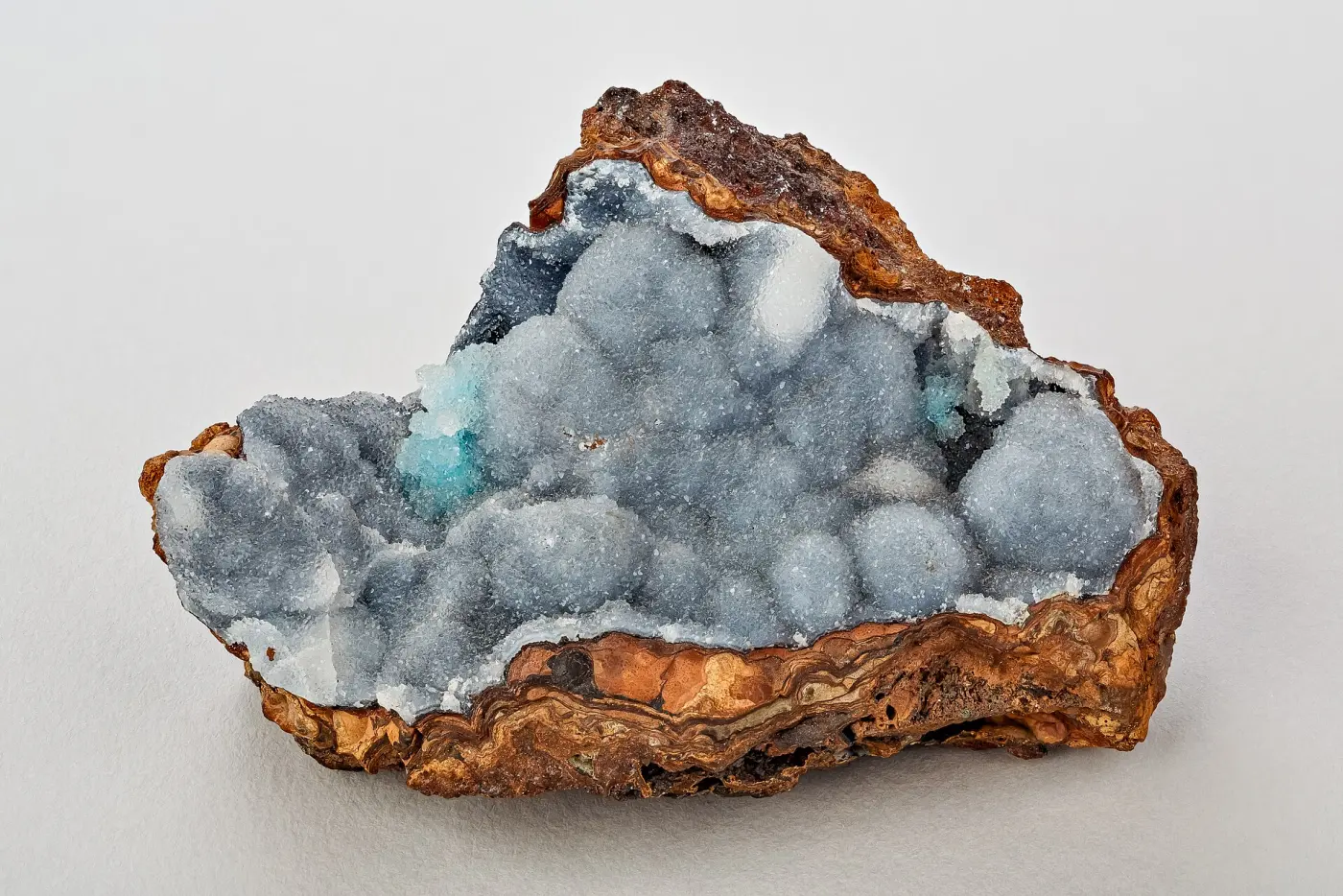
Tishomingo State Park Geodes
Rockhounding site in Tishomingo, Mississippi · Geodes
Tishomingo State Park Geodes is a geode rockhounding site near Tishomingo, MS. Fee required. Best season: Late autumn through early spring, when leaf cover is down and the outcrops and creek gravel are visible.
Typical season: Late autumn through early spring, when leaf cover is down and the outcrops and creek gravel are visible
About Tishomingo State Park Geodes
Tishomingo State Park occupies a corner of Mississippi that does not look like Mississippi. It sits in the far northeast of the state, where the Appalachian foothills cross the line, and it is the only place in Mississippi where that happens. Instead of coastal plain sediments, visitors find massive sandstone outcrops, rock shelters, overhangs and a creek cutting through them.
The bedrock is Mississippian and Pennsylvanian sandstone and chert, the southwestern extremity of the Appalachian sequence. Weathering has carved the sandstone into shelters and ledges that supported human occupation from the Archaic period onward, and Bear Creek runs through the park with canoe rentals and a swinging bridge crossing.
On geodes, it is worth setting expectations honestly. This is not a classic geode belt on the scale of Keokuk or the Cumberland Plateau. What the sandstone and chert units realistically produce is chert, silicified material, concretions and occasional small nodules, concentrated in Bear Creek gravel. Mississippi state parks generally restrict removing natural features, and Tishomingo is noted as permitting personal rock collecting with prior approval from park staff, which makes asking at the office the first step of any collecting visit.
Key facts
Structured details for trip planning — verify access and fees with the land manager before you visit.
- Specimen type
- Geode
- Primary specimens
- Chert, Quartz, Sandstone Concretions, Small Geodes, Agate
- Fee status
- Fee required
- Nearest town
- Tishomingo
- State
- Mississippi
- Coordinates
- 34.63000, -88.23000
- Best season
- Late autumn through early spring, when leaf cover is down and the outcrops and creek gravel are visible
- Access difficulty
- Easy. Maintained trails through rock outcrops and along Bear Creek, with a swinging bridge and canoe access
- Collecting hazards
- See safety tips
- Camping
- Developed campground and cabins in the park, plus primitive sites. Reserve ahead in spring and autumn
- Land manager
- U.S. Forest Service
- Activities
- Hiking among the sandstone outcrops, canoeing Bear Creek, geology observation. Collecting only with prior staff approval
- Facilities
- Campground, cabins, disc golf, swimming pool, canoe rentals on Bear Creek, hiking trails, picnic areas, restrooms
- Last updated
- 2026-09-15
What to pack for Tishomingo State Park Geodes
Gear we compare for geodes trips like this one — tools, safety, and the hike in.


Disclosure: Gear links may earn a commission as an Amazon Associate — at no extra cost to you. Learn more.
The experience
- Best time to visitLate autumn through early spring, when leaf cover is down and the outcrops and creek gravel are visible
- AccessEasy. Maintained trails through rock outcrops and along Bear Creek, with a swinging bridge and canoe access
- FacilitiesCampground, cabins, disc golf, swimming pool, canoe rentals on Bear Creek, hiking trails, picnic areas, restrooms
- Camping nearbyDeveloped campground and cabins in the park, plus primitive sites. Reserve ahead in spring and autumn
Highlights & features
- The only place in Mississippi where the Appalachian foothills extend into the state
- Massive sandstone outcrops and rock shelters unlike anything else in the Mississippi landscape
- Bear Creek runs through the park with canoe rentals and a swinging bridge crossing
- Personal rock collecting is possible here with prior approval from park staff, which is unusual for a Mississippi state park
- A Civilian Conservation Corps park with 1930s stonework still in use
- The park sits on Mississippian and Pennsylvanian sandstone and chert, the southwestern tip of the Appalachian sequence
- Weathering has carved rock shelters and overhangs into the sandstone, features found nowhere else in the state
- Chert and silicified material from these units is the realistic find rather than classic hollow geodes
How to get there
Tishomingo State Park is off the Natchez Trace Parkway at milepost 304, near Tishomingo in the far northeast corner of Mississippi, close to both the Alabama and Tennessee lines. All approaches are paved and easy in any vehicle, including RVs bound for the campground. The Natchez Trace approach is the scenic option and is worth the extra time. Call the park on 662-438-6914 for current conditions and to ask about collecting before you arrive.
From Iuka, take Mississippi Highway 25 south; from Tupelo, the Natchez Trace Parkway runs northeast directly to the park entrance. Interstate 22 to the south and Interstate 65 well to the east are the nearest interstates.
Plan your visit
Start at the park office. Asking about collecting before you do any is both the rule here and the difference between a good visit and a problem.
Bring hiking shoes, a hand lens, a camera, insect repellent and water. If staff approve collecting, a small bag and a spray bottle are all you need, since this is surface searching in creek gravel rather than digging.
Timing: late autumn through early spring for visibility. Facilities: campground, cabins, swimming pool, disc golf, canoe rentals, trails, restrooms.
Walk the outcrop trails and the swinging bridge first, both because they are the reason the park exists and because they show you what the rock actually is. Bear Creek gravel bars are the realistic place to find loose chert and silicified material. Canoe rentals make a half-day trip on the creek easy. See other Mississippi collecting areas, several of which are less restricted than a state park.
Things you need to take to Tishomingo State Park Geodes

NoCry Professional Construction Knee Pads
Buy once — your knees will notice by lunch.
Check price on Amazon
DEWALT DPG82 Concealer Safety Glasses
Buy two pairs — one lives in your pack permanently.
Check price on Amazon
Osborn 8-Piece Wire & Nylon Brush Set
The standard field brush kit — keep one in every pack.
Check price on Amazon
Osprey Talon 22 Backpack
The pack to save for if you collect more than a few times a year.
Check price on AmazonDisclosure: Gear links may earn a commission as an Amazon Associate — at no extra cost to you. Learn more.
Access & fees
Mississippi state parks generally restrict removing natural features, and that is the default assumption to work from. Tishomingo is noted as permitting personal rock collecting with prior approval from park staff, which is a meaningful exception but one that depends entirely on asking first. So the process is: visit the office, explain what you want to do and where, and abide by whatever staff say. Approval is not a formality and it may be limited to specific areas or declined outright depending on conditions and season. Rock shelters and any archaeological material are protected and entirely off limits regardless of collecting approval. Northeast Mississippi's shelters record Archaic period occupation and are legally protected. Outside the park, land is largely private, with some Tennessee Valley Authority and national forest ground in the wider region. Do not assume creek access across private land is open. If your goal is volume collecting, plan around Mississippi's national forest ground and permitted private sites rather than around a state park.
Mississippi state parks generally restrict removing natural features, and that is the default assumption to work from. Tishomingo is noted as permitting personal rock collecting with prior approval from park staff, which is a meaningful exception but one that depends entirely on asking first.
So the process is: visit the office, explain what you want to do and where, and abide by whatever staff say. Approval is not a formality and it may be limited to specific areas or declined outright depending on conditions and season.
Rock shelters and any archaeological material are protected and entirely off limits regardless of collecting approval. Northeast Mississippi's shelters record Archaic period occupation and are legally protected.
Outside the park, land is largely private, with some Tennessee Valley Authority and national forest ground in the wider region. Do not assume creek access across private land is open. If your goal is volume collecting, plan around Mississippi's national forest ground and permitted private sites rather than around a state park.
Frequently asked questions
Can you collect rocks at Tishomingo State Park?
Only with prior approval from park staff. Mississippi state parks generally restrict removing natural features, and Tishomingo is noted as permitting personal rock collecting when staff approve it in advance. Visit the office and ask before collecting anything; approval is not automatic and may be limited or declined.
Are there really geodes at Tishomingo State Park?
Not in the classic sense. The Mississippian and Pennsylvanian sandstone and chert units here realistically produce chert, silicified material, concretions and occasional small nodules rather than the hollow crystal-lined geodes of the Keokuk belt or the Cumberland Plateau. Bear Creek gravel is where loose material concentrates.
Why does Tishomingo State Park look so different from the rest of Mississippi?
Because it is the only place in the state where the Appalachian foothills extend across the line. Instead of coastal plain sediments, the park sits on Mississippian and Pennsylvanian sandstone, weathered into massive outcrops, rock shelters and overhangs that exist nowhere else in Mississippi.
Where is Tishomingo State Park?
Off the Natchez Trace Parkway at milepost 304 in the far northeast corner of Mississippi, near Tishomingo and close to both the Alabama and Tennessee lines. It is reached from Iuka on Mississippi Highway 25 or directly along the Natchez Trace from Tupelo.
What can you do at Tishomingo State Park?
Hike the sandstone outcrop trails, cross the swinging bridge, canoe Bear Creek with rentals available in season, camp or stay in a cabin, and use the pool and disc golf course. For geology visitors, the outcrops and rock shelters are the draw, with collecting only by staff approval.
Where can you find geodes in Mississippi?
Mississippi is not a strong geode state. Creek gravels in the north of the state and national forest ground produce chert, agate and silicified material, and specific creek sites are better documented than any state park. Because state parks restrict removing natural features, permitted private ground and national forest land are the practical options.
Is Tishomingo State Park worth visiting?
Yes, particularly for anyone interested in geology or landscape, because the sandstone outcrops and rock shelters are unique in Mississippi. It also has a full campground, cabins, a pool, disc golf and canoe rentals on Bear Creek, which makes it a genuine weekend destination rather than a quick stop.
What are the rock shelters at Tishomingo?
Overhangs and shallow caves weathered into the sandstone, which record human occupation from the Archaic period onward. They are archaeologically protected, so they can be viewed and photographed from the trails but must not be disturbed, dug or have material removed from them under any circumstances.
Can you canoe at Tishomingo State Park?
Yes. Canoe rentals operate on Bear Creek in season and are one of the most popular activities in the park, giving a view of the sandstone walls that the trails do not. Check conditions before setting out, since the creek rises quickly after heavy rain.
Does Mississippi allow rock collecting on public land?
It varies by land manager. State parks restrict removing natural features, with Tishomingo noted as allowing personal collecting by prior staff approval. National forest land in Mississippi generally allows casual personal collecting with hand tools. Private land, which is most of the state, requires the owner's permission.
Do Mississippi collectors rate the state for rockhounding?
Honestly, no, and discussions tend to say so plainly. Mississippi's coastal plain geology produces gravel, chert, petrified wood and fossils rather than the crystal pockets and pegmatites that draw collectors elsewhere, and the state has comparatively little open public land. What people do recommend is creek gravel in the north of the state, national forest ground, and fossil hunting, with Tishomingo valued more for its unusual Appalachian scenery than for what you can carry out of it.
Is it worth asking park staff for collecting permission at a state park?
Collectors who have done it describe it as worth the two minutes, and note that the answer depends heavily on what you ask for. Requests to pick up a few loose pieces of chert from creek gravel fare far better than requests to dig, and staff are more likely to agree when you explain exactly where you want to look. The broader point people make is that asking builds the relationship that keeps these exceptions available, while collecting quietly and hoping nobody notices is what gets them withdrawn.
Explore related hubs
Report an access change
Field conditions change. If this site is closed, claimed, flooded, or the fee has changed, tell us — we update listings with community tips and desk verification.
Include the date you visited and any land-manager contact. Do not share private gate codes.
Map & location
Culture & history
Tishomingo State Park was built by the Civilian Conservation Corps in the 1930s, and the stonework from that era, including bridges and structures, is still in use. The park is named for Chief Tishomingo of the Chickasaw, whose people were removed from this region in the nineteenth century. The rock shelters in the park record human use going back to the Archaic period, and that archaeological significance sits alongside the geological one. The Natchez Trace, which now brings most visitors to the gate, follows a corridor used for travel and trade long before European arrival.
Conservation
This is a small, heavily visited park protecting geology found nowhere else in the state, alongside archaeological sites. The collecting approval requirement exists precisely because of that. Ask staff, take only what they permit, and stay on trails where the sandstone and its thin soils erode quickly under foot traffic. Never disturb rock shelters, never remove archaeological material, and do not carve or mark sandstone, which takes graffiti permanently. Pack out all litter and keep out of Bear Creek during high water when banks are unstable.
Sources & updates
Official land managers cited on this page
Always confirm current rules, closures, and fees on the agency site before visiting.
Spotted outdated access, fees, or safety info? Use Report an access change on this page or send a correction with the page URL — we review every submission.