Utah geode beds on BLM land west of the Sevier Desert — led by the Dugway Geode Beds — are among the most searched free nodule fields in the U.S. Plan for high-clearance roads, self-rescue distances, summer heat, and military-range notices near Dugway Proving Ground.
3 spots in Utah.
Utah geode beds on BLM land — especially Dugway Geode Beds — are the top free public nodule fields for “geode beds Utah” and “Utah geode beds” searches. Pair with Topaz Mountain on a cool-season west-desert loop, sort distance with geodes near me, and browse pay-to-dig sites when you want a managed day. See all rockhounding in Utah on the state map.
What are Utah geode beds?
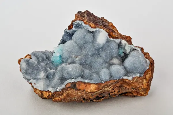
Utah geode beds are desert exposures where hollow nodules of quartz and chalcedony weather out of volcanic and sedimentary layers — most famously at the Dugway Geode Beds on BLM land. This hub lists 3 related Utah directory sites for trip planning; geology and access differ by pin, so open each listing before you drive.
Searches for “geode beds Utah” and “Utah geode beds” usually mean Dugway first, then nearby west-desert localities. Topaz Mountain is a topaz rhyolite site, not a geode bed, but pairs well on the same cool-season loop.
Dugway, Topaz Mountain, and desert logistics
Start with the Dugway Geode Beds listing for GPS, BLM context, and heat warnings. Add Topaz Mountain if you want free BLM topaz crystals the same weekend. Fillmore and related pins below cover additional Utah context — confirm land status on every card.
Spring and fall are the realistic seasons. Summer exceeds 100°F with no services; winter storms can close dirt roads. Carry extra water, fuel, offline maps, and eye protection when cracking nodules.
Plan with maps and gear
Sort live distance with geodes near me GPS, browse the national dig-sites map for fee options, and use the Utah rockhounding state hub as your statewide map. Pack from the essential rockhounding tools guide — desert geode work needs glasses, hammer, chisel, screen, and buckets.
The flagship free public beds are the Dugway Geode Beds on BLM land west of Delta. Our Dugway listing and this Utah geode beds region hub cover roads, heat, and collecting basics.
Are Utah geode beds free to collect?
Casual personal collecting at Dugway is generally allowed on BLM ground within federal personal-use limits — no entrance fee, but you must bring water, fuel, and current road/fire status. Rules can change; verify before digging.
What tools do I need at Utah geode beds?
Pack safety glasses, a rock hammer or crack hammer, cold chisel, gloves, buckets, and a quarter-inch screen for gravel sorting. See our essential rockhounding tools guide and rock hammers guide before a desert trip.
Can I combine Dugway with Topaz Mountain?
Yes — Topaz Mountain is a separate BLM topaz locality roughly 14 miles from Dugway. Many Salt Lake City collectors pair both on a cool-season west-desert weekend; see our Utah rockhounding map for GPS and access notes.
Public BLM geode locality in western Juab County, Utah, where Miocene rhyolite cavities were eroded by ancient Lake Bonneville and redeposited as quartz-lined geodes in soft lakebed sediment along the Pony Express Road.
Fillmore is a documented mineral occurrence near UT. Reported specimens include Anhydrite, Gypsite, Gypsum, Niter. Verify land access and collecting rules before visiting.
Free BLM rockhound recreation area in the Thomas Range 55 miles west of Delta, Utah, where sherry-coloured topaz crystals weather out of rhyolite vugs alongside red beryl, bixbyite and garnet, and the topaz fades to clear in sunlight.