
Lincoln Gulch
Rockhounding site in Utah, Utah · Quartz & Crystals
Lincoln Gulch is a amethyst rockhounding site near Utah, UT. Fee required. Best season: Late spring through fall for dry desert-mountain roads.
Typical season: Late spring through fall for dry desert-mountain roads
About Lincoln Gulch
Lincoln Gulch sits in the Lincoln Mining District of Beaver County, Utah, roughly thirteen miles west of Beaver and north of Minersville. The district produced copper, gold, silver, and tungsten from hydrothermal systems cut by historic mines and prospects. Rockhound interest centers on reports that the Creole Mine carried amethyst as gangue alongside fluorite, epidote, garnet, and scheelite, a mineralogical footnote preserved in locality databases and Utah geologic literature.
This is not a signed public fee dig. Land ownership mixes Bureau of Land Management tracts with private ground and mining claims. Some ground that looks empty on a satellite image may still be claimed or closed. Surface collecting, if it is legal at all on a given acre, requires confirming that you are on open land without a conflicting claim and that you have landowner permission on private parcels.
The practical message for visitors is caution and research. Study the district as mining history, stay out of underground workings, and contact BLM Cedar City Field Office before assuming any amethyst is yours to take. A photograph of a dump and a copied claim map are better souvenirs than a trespass citation or a fall into a forgotten shaft.
Key facts
Structured details for trip planning — verify access and fees with the land manager before you visit.
- Specimen type
- Amethyst
- Primary specimens
- Amethyst, Fluorite, Epidote, Garnet, Scheelite, Chalcopyrite, Azurite, Malachite, Quartz
- Fee status
- Fee required
- Nearest town
- Utah
- State
- Utah
- Coordinates
- 38.26297, -112.88818
- Best season
- Late spring through fall for dry desert-mountain roads. Summer thunderstorms and winter snow can close or complicate access
- Access difficulty
- Moderate to difficult navigation on historic mining terrain with unmarked hazards. Not a developed walk-up collecting park
- Collecting hazards
- Access restrictions
- Camping
- Dispersed camping may be possible on open BLM land where allowed and away from claims and private property. Confirm current rules with BLM Cedar City Field Office
- Land manager
- Bureau of Land Management
- Activities
- Historical and geologic study of the Lincoln Mining District, photography from safe public ground, and claim research. Do not enter shafts, adits, or unstable stopes
- Facilities
- No developed rockhound facilities at the district. Supplies and lodging are in Beaver and Minersville
- Last updated
- 2026-09-15
What to pack for Lincoln Gulch
Gear we compare for quartz & crystals trips like this one — tools, safety, and the hike in.

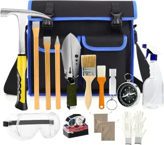


Disclosure: Gear links may earn a commission as an Amazon Associate — at no extra cost to you. Learn more.
The experience
- Best time to visitLate spring through fall for dry desert-mountain roads. Summer thunderstorms and winter snow can close or complicate access
- AccessModerate to difficult navigation on historic mining terrain with unmarked hazards. Not a developed walk-up collecting park
- FacilitiesNo developed rockhound facilities at the district. Supplies and lodging are in Beaver and Minersville
- Camping nearbyDispersed camping may be possible on open BLM land where allowed and away from claims and private property. Confirm current rules with BLM Cedar City Field Office
Highlights & features
- Historic Lincoln Mining District in Beaver County about 13 miles west of Beaver and north of Minersville
- Creole Mine documentation lists amethyst as gangue with fluorite, epidote, garnet, and scheelite
- District commodities historically include copper, gold, silver, and tungsten
- Land status is a patchwork of BLM, private parcels, and active or historic claims
- Treat this as a historic district lead, not a confirmed public walk-up amethyst dig
- Amethyst at Creole Mine is described as gangue in a polymetallic hydrothermal system rather than a simple crystal pocket park
- Scheelite and other tungsten minerals tie the district to broader Beaver County mining history
- Utah Geological Survey bulletin literature and Mindat locality pages are the primary documentation trail
How to get there
Beaver and Minersville are the service towns on or near Interstate 15 and Utah Highway 21 in southwestern Utah. The Lincoln District lies in the hills west of Beaver and north of Minersville; exact gulch access depends on current road conditions and land status, so start with a BLM map rather than a pin drop alone. Stop in Beaver for fuel and water. Call BLM Cedar City Field Office at 435-865-3000 for public land questions, and be prepared to turn around if signs or occupants indicate private or claimed ground.
From Beaver, county and dirt roads lead west into historic mining country. High-clearance vehicles are wise, and wet weather can stop two-wheel-drive traffic. Do not drive across private driveways or claim workings marked against entry.
Plan your visit
Plan research first: read Utah Geological Survey material on the Lincoln District and check Mindat or claim records so you understand Creole Mine mineralogy and ownership complexity. Then decide whether your trip is scenic history or a carefully vetted surface visit on confirmed open land.
Pack hiking boots, sun protection, abundant drinking water, and a paper map. Leave underground exploration gear at home; there is no safe recreational shaft tour here. If you cannot verify that a dump or hillside is open and legal, do not collect.
For guaranteed Utah crystal experiences, choose advertised fee digs or clearly signed collecting areas elsewhere in the state. See Utah collecting areas and treat Lincoln Gulch as an advanced land-status problem, not a beginner amethyst field.
Things you need to take to Lincoln Gulch
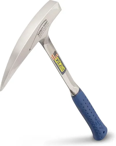
Estwing 22 oz Geological Pick
If you buy one hammer, make it this one.
Check price on Amazon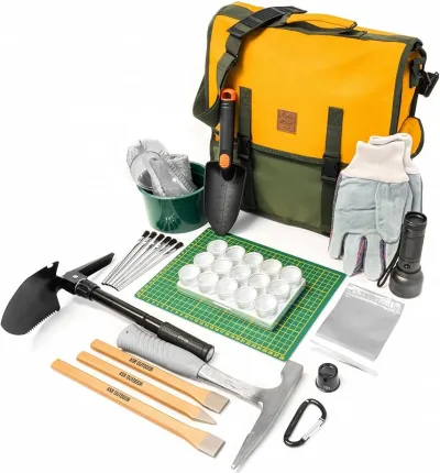
ASR Outdoor 38pc Deluxe Rock Hounding Kit
The kit to buy when you want prospecting-grade accessories, not just a hammer in a bag.
Check price on Amazon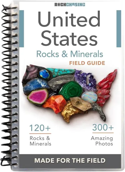
Rock Chasing US Rocks & Minerals Field Guide
The guide to clip on your pack when you do not know what you are looking at yet.
Check price on Amazon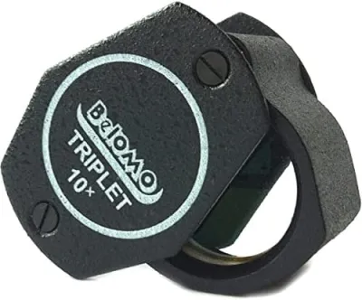
BelOMO 10x Triplet Loupe
The loupe to buy once and carry for decades.
Check price on AmazonDisclosure: Gear links may earn a commission as an Amazon Associate — at no extra cost to you. Learn more.
Access & fees
Expect mixed BLM public land, private property, and mining claims throughout the Lincoln District. Public land availability does not erase claim rights. Collecting on a claim or private parcel without permission is illegal. BLM Cedar City Field Office administers much of the public land in Beaver County mineral country. Ask them about motorized access, dispersed camping, and any temporary closures. Written landowner permission is required on private inholdings. No part of this guidance authorizes entering underground mine workings. Surface only, and only where you have a clear legal right.
Expect mixed BLM public land, private property, and mining claims throughout the Lincoln District. Public land availability does not erase claim rights. Collecting on a claim or private parcel without permission is illegal.
BLM Cedar City Field Office administers much of the public land in Beaver County mineral country. Ask them about motorized access, dispersed camping, and any temporary closures. Written landowner permission is required on private inholdings.
No part of this guidance authorizes entering underground mine workings. Surface only, and only where you have a clear legal right.
Frequently asked questions
Can the public dig amethyst at Lincoln Gulch?
Not as a confirmed walk-up public dig. Lincoln Gulch is a historic mining district with mixed BLM, private, and claim ownership. Amethyst is documented as Creole Mine gangue in literature, but you must verify legal access before any surface collecting and you should not treat the district like an open gem park.
Where is the Lincoln Mining District relative to Beaver and Minersville?
The district lies in Beaver County roughly thirteen miles west of Beaver and north of Minersville in southwestern Utah. Those towns are the practical places to fuel, sleep, and ask local road questions before driving into historic mining country.
What minerals are associated with the Creole Mine?
Locality references describe amethyst as gangue with fluorite, epidote, garnet, and scheelite in a broader copper-gold-silver-tungsten system. That assemblage is why rockhounds read about Lincoln Gulch, even though access today is constrained by claims and private land.
Is it safe to explore old mine shafts near Lincoln Gulch?
No. Do not enter shafts, adits, or stopes. Abandoned underground mines can collapse, contain toxic or oxygen-poor air, and hide flooded winzes. Stay on the surface, keep back from collars and fences, and leave underground exploration to licensed professionals.
Who manages public land questions for Beaver County mineral areas?
BLM Cedar City Field Office is the primary federal contact for much of Beaver County public land and can be reached at 435-865-3000. Staff can help with maps, access questions, and reminders that mining claims may still restrict collecting on otherwise public parcels.
Do I need permission to collect on a mining claim?
Yes. A mining claim gives the claimant rights that generally block casual collecting by the public. If ground is claimed or private, you need the claimant's or landowner's permission. Collecting without that permission is trespass and can be prosecuted.
Why is Lincoln Gulch listed if collecting is uncertain?
Historic districts remain important for geology education and for collectors researching specimen provenance. Listing the locality with honest access notes prevents people from assuming every Mindat pin is an open dig, while still documenting Creole Mine amethyst and related minerals correctly.
What should I bring if I only visit for history and photography?
Bring sturdy shoes, sun protection, drinking water, paper maps, and a charged camera. Leave climbing gear for shafts at home. Stay on legal roads and public viewpoints, and be ready to leave if you encounter posted claims or private property.
When is the best season to drive western Beaver County backroads?
Late spring through fall usually offers the most reliable dry-road access around Beaver and Minersville. Summer monsoon storms can dump rain quickly, and winter snow or mud can stop travel. Always check conditions locally before committing to remote dirt roads.
Explore related hubs
Report an access change
Field conditions change. If this site is closed, claimed, flooded, or the fee has changed, tell us — we update listings with community tips and desk verification.
Include the date you visited and any land-manager contact. Do not share private gate codes.
Map & location
Culture & history
Beaver County mining camps and districts such as Lincoln grew with nineteenth- and twentieth-century metal demand, leaving headframes, dumps, and place names on the landscape west of Beaver. Creole Mine entered mineralogical notes because its gangue assemblage included amethyst with fluorite and calc-silicate minerals, not because it operated as a gem park. Those industrial landscapes are historic resources and hazard zones at the same time. Photographing from safe ground and reading survey bulletins continues the district story without repeating the injuries that plague abandoned mine recreation.
Conservation
Abandoned mine lands are fragile and dangerous. Staying out of workings protects both visitors and bats or other species that may use openings. Do not vandalize historic structures or drag ore from labeled claims. Pack out trash, avoid creating new roads, and report hazardous open shafts to BLM when you can do so safely from a distance. Responsible behavior keeps public land discussions focused on recreation access rather than rescue statistics.
Sources & updates
Official land managers cited on this page
Always confirm current rules, closures, and fees on the agency site before visiting.
Spotted outdated access, fees, or safety info? Use Report an access change on this page or send a correction with the page URL — we review every submission.