
Buffalo
Rockhounding site in Oklahoma, Oklahoma · Agate & Jasper
Buffalo is a agate rockhounding site near Oklahoma, OK. Fee varies. Best season: Late autumn through early spring.
Typical season: Late autumn through early spring
About Buffalo
Buffalo is the county seat of Harper County in the far northwest of Oklahoma, sitting on the Beaver River in high plains country near the Kansas line. It appears in mineral records as an occurrence for agate, chalcedony, chert and jasper, and understanding what that means matters more here than in most entries.
This is not a named collecting site with a defined outcrop. It is a documented occurrence in an area where silicified material is widely distributed. The landscape is capped by the Ogallala Formation, the great Miocene to Pliocene sheet of sand, gravel and caliche that underlies the southern High Plains, and silica-rich groundwater in that formation produced hard silicified zones that break down into agate and chalcedony float. Stream gravels along the Beaver River and its draws concentrate that material, and petrified wood turns up in the wider Ogallala belt across the Oklahoma and Texas panhandles.
The controlling factor is land. Harper County is almost entirely private ranch and farm ground, and Oklahoma has very little public land here. Collecting means arranging permission first, and in ranching country that is a conversation rather than a formality.
Key facts
Structured details for trip planning — verify access and fees with the land manager before you visit.
- Specimen type
- Agate
- Primary specimens
- Agate, Chalcedony, Chert, Jasper, Petrified Wood
- Fee status
- Fee varies
- Nearest town
- Oklahoma
- State
- Oklahoma
- Coordinates
- 36.84990, -99.62775
- Best season
- Late autumn through early spring. Summer heat on the open plains is severe, and low vegetation in winter makes surface material far easier to spot
- Access difficulty
- Easy walking on flat to gently rolling terrain. The difficulty is arranging access, not covering ground
- Collecting hazards
- See safety tips
- Camping
- No developed campgrounds in the immediate area; options exist at state parks elsewhere in northwestern Oklahoma
- Land manager
- U.S. Fish & Wildlife Service
- Activities
- Surface searching stream gravels, draws and eroded exposures, where landowner permission has been obtained
- Facilities
- Buffalo has fuel, food and basic services. Nothing in the field
- Last updated
- 2026-09-15
What to pack for Buffalo
Gear we compare for agate & jasper trips like this one — tools, safety, and the hike in.



Disclosure: Gear links may earn a commission as an Amazon Associate — at no extra cost to you. Learn more.
The experience
- Best time to visitLate autumn through early spring. Summer heat on the open plains is severe, and low vegetation in winter makes surface material far easier to spot
- AccessEasy walking on flat to gently rolling terrain. The difficulty is arranging access, not covering ground
- FacilitiesBuffalo has fuel, food and basic services. Nothing in the field
- Camping nearbyNo developed campgrounds in the immediate area; options exist at state parks elsewhere in northwestern Oklahoma
Highlights & features
- High plains country in Harper County, northwestern Oklahoma, on the Beaver River
- Agate, chalcedony, chert and jasper are the reported finds
- The Ogallala Formation caps much of this landscape and yields silicified material
- Open, gently rolling terrain makes surface searching straightforward where access is arranged
- Within reach of the Oklahoma Panhandle collecting country to the west
- Silica-rich groundwater in the Ogallala Formation produced caliche and silicified zones that break down into agate and chalcedony float
- The Beaver River, which becomes the North Canadian downstream, carries gravel east across the region
- Petrified wood occurs in the broader Ogallala outcrop belt across the Oklahoma and Texas panhandles
How to get there
Buffalo sits at the junction of US Highway 64 and US Highway 183 in Harper County, northwestern Oklahoma, roughly 40 miles south of the Kansas border and about two and a half hours northwest of Oklahoma City. The highways are paved and straightforward. Beyond them the county road grid is gravel and dirt section-line road, generally passable in a passenger car when dry but slick and rutted after rain, with long distances between anything. Fuel and basic services are in Buffalo itself. Woodward, roughly 30 miles southeast, is the nearest larger town. Carry water and a full tank, because the gaps between services out here are longer than the map suggests, and cell coverage is inconsistent.
Buffalo sits at the junction of US Highway 64 and US Highway 183 in Harper County, northwestern Oklahoma, roughly 40 miles south of the Kansas border and about two and a half hours northwest of Oklahoma City.
The highways are paved and straightforward. Beyond them the county road grid is gravel and dirt section-line road, generally passable in a passenger car when dry but slick and rutted after rain, with long distances between anything.
Fuel and basic services are in Buffalo itself. Woodward, roughly 30 miles southeast, is the nearest larger town. Carry water and a full tank, because the gaps between services out here are longer than the map suggests, and cell coverage is inconsistent.
Plan your visit
The most important preparation is not equipment but access. Identify the landowner of the ground you want to search, ask permission in advance, and agree where you may park and drive.
With that arranged, bring a bucket or bag, a spray bottle, a hand lens, sun protection, boots for rough ground and plenty of water. A rock hammer is less useful than sharp eyes, since most material is found as surface float rather than broken from outcrop.
Timing: late autumn through early spring. Facilities: fuel and food in Buffalo; nothing in the field.
Search draws, cut banks, stream gravel and the edges of eroded exposures, where runoff concentrates resistant silicified material. Winter is genuinely the better season: vegetation is down, temperatures are workable, and the agate stands out. Combine the trip with other Oklahoma collecting areas and with the Panhandle counties to the west.
Things you need to take to Buffalo
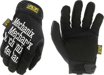
Mechanix Work Gloves with Grip
The default glove for collectors who need feel and protection.
Check price on Amazon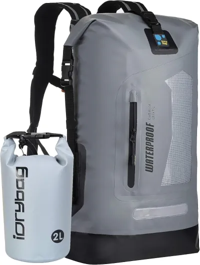
Osprey Talon 22 Backpack
The pack to save for if you collect more than a few times a year.
Check price on Amazon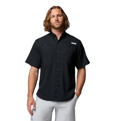
Willit UPF 50+ Sun Shirt UPF 50+
The best all-around sun shirt for rockhounding sites — light enough to collect at, dry enough to hike out in.
Check price on Amazon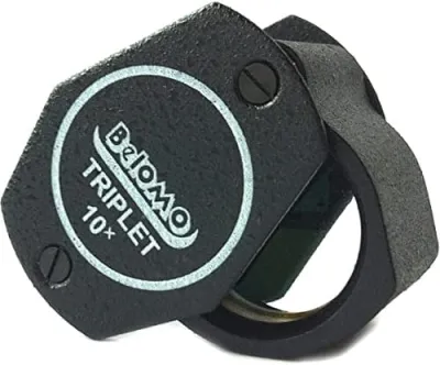
BelOMO 10x Triplet Loupe
The loupe to buy once and carry for decades.
Check price on AmazonDisclosure: Gear links may earn a commission as an Amazon Associate — at no extra cost to you. Learn more.
Access & fees
Harper County is almost entirely private land, and this is the single fact that governs collecting here. Oklahoma has comparatively little federal or state land generally, and essentially none in this corner of the state. That means landowner permission is required for any collecting, including in creek beds crossing private ground. Section-line roads are public right of way for travel, but that does not extend to collecting from adjacent land or to parking on a rancher's field edge. Do not assume unfenced land is open. Ranching country runs on gates and fences. Close every gate behind you, do not drive across planted or grazed ground, and do not disturb livestock or water infrastructure. Ask specifically what is allowed rather than inferring it, and honour the limits you agree to. A collector who does that is often welcome back; one who does not closes the ground for everyone.
Harper County is almost entirely private land, and this is the single fact that governs collecting here. Oklahoma has comparatively little federal or state land generally, and essentially none in this corner of the state.
That means landowner permission is required for any collecting, including in creek beds crossing private ground. Section-line roads are public right of way for travel, but that does not extend to collecting from adjacent land or to parking on a rancher's field edge. Do not assume unfenced land is open.
Ranching country runs on gates and fences. Close every gate behind you, do not drive across planted or grazed ground, and do not disturb livestock or water infrastructure. Ask specifically what is allowed rather than inferring it, and honour the limits you agree to. A collector who does that is often welcome back; one who does not closes the ground for everyone.
Frequently asked questions
Can you collect rocks around Buffalo, Oklahoma?
Only with landowner permission. Harper County is almost entirely private ranch and farm land, and Oklahoma has very little public land in this corner of the state. Section-line roads are public right of way for travel but that does not extend to collecting from adjacent property.
What minerals are found near Buffalo, Oklahoma?
Agate, chalcedony, chert and jasper are the reported finds, with petrified wood occurring in the wider Ogallala Formation belt across the Oklahoma and Texas panhandles. Silica-rich groundwater in the Ogallala produced silicified zones that break down into agate and chalcedony float.
When is the best time to search this area?
Late autumn through early spring. Vegetation is down so surface material is far easier to spot, and temperatures are workable. Summer heat on the open High Plains is severe with almost no shade, and spring brings severe thunderstorm and tornado risk.
Where exactly is the collecting site at Buffalo?
There is no single defined site. This is documented as a mineral occurrence across an area rather than a named locality with a trailhead, so the productive ground is wherever runoff has concentrated silicified float: draws, cut banks, stream gravels and eroded exposures, all on private land.
What is the Ogallala Formation?
A Miocene to Pliocene sheet of sand, gravel and caliche that underlies the southern High Plains, including northwestern Oklahoma. Silica-rich groundwater within it produced hard silicified zones, which weather down into the agate and chalcedony float collectors find. It is also the aquifer that made High Plains irrigation possible.
What is caliche?
A hardened deposit of calcium carbonate that forms in soil in arid and semi-arid regions, common in the Ogallala Formation of the High Plains. Silica-rich groundwater in the same sediments produced silicified zones that break down into the agate and chalcedony float collectors find in northwestern Oklahoma.
Where is the best rockhounding in Oklahoma?
The Oklahoma Panhandle and northwest for agate, jasper and petrified wood; the Great Salt Plains for selenite crystals, which is a genuinely unique public dig; and central Oklahoma for barite rose, the state rock. Access on private ranch land is the recurring constraint outside the few public sites.
What is the Beaver River in Oklahoma?
The stream that becomes the North Canadian River downstream, running east across the Oklahoma Panhandle and northwestern Oklahoma past Buffalo in Harper County. It carries gravel east across the region, which is why its draws and banks concentrate the silicified material collectors look for.
Can you dig selenite crystals in Oklahoma?
Yes, at the Salt Plains National Wildlife Refuge near Jet, where a designated digging area is open seasonally and visitors may collect the distinctive hourglass selenite crystals. It is the state's best known public collecting site and a very different proposition from the private ranch land around Buffalo.
Do you need permission to collect in Oklahoma?
On private land, always, and Oklahoma is overwhelmingly private. The state has comparatively little public land, and essentially none in Harper County. Section-line roads are public right of way for travel but that does not extend to collecting from adjacent property.
How do collectors approach ranchers in the Oklahoma panhandle country?
The advice mirrors what hunters do in the same country: find the landowner through the county office or a neighbour, ask by phone or in person rather than at a gate, be specific about what you want to do and where, offer to stay out of planted ground and close every gate, and accept a refusal cleanly. People report that requests to walk a draw or a creek for surface rock are received far better than anything involving digging or driving across pasture.
Is northwest Oklahoma worth a trip for agate?
Opinions are lukewarm unless you already have access. Collectors describe the Ogallala float as real but scattered, with no named collecting site to head for, and note that the whole area is private ranch land so the trip only works if the permission is arranged first. Those who recommend it usually pair it with the Salt Plains selenite dig further east, which gives the trip a guaranteed public component.
Explore related hubs
Report an access change
Field conditions change. If this site is closed, claimed, flooded, or the fee has changed, tell us — we update listings with community tips and desk verification.
Include the date you visited and any land-manager contact. Do not share private gate codes.
Map & location
Culture & history
Harper County was opened to settlement in the Cherokee Outlet land run of 1893, and Buffalo has been its seat since the county was organised at statehood in 1907. The economy has been ranching and dryland farming ever since, with oil and gas layered on top. The Beaver River, which becomes the North Canadian downstream, was a route across the plains long before that. The Ogallala Formation that underlies the landscape is better known as the aquifer that made irrigated farming possible across the High Plains, and its depletion is the defining regional issue of the present day.
Conservation
The conservation issue here is almost entirely about landowner relations. Ranch families in northwestern Oklahoma have long memories for people who left gates open, cut fences or drove across a wheat field. Surface collect rather than dig, take modest amounts, pack out every scrap including other people's litter, and stay out of stock tanks and water gaps. Avoid driving on soft ground after rain, where a single vehicle leaves ruts that persist for a season. Keep to the access you were given, and say thank you afterwards.
Sources & updates
Official land managers cited on this page
Always confirm current rules, closures, and fees on the agency site before visiting.
Spotted outdated access, fees, or safety info? Use Report an access change on this page or send a correction with the page URL — we review every submission.