
Ounce Creek
Rockhounding site in Wisconsin, Wisconsin · Agate & Jasper
Ounce Creek is a agate rockhounding site near Wisconsin, WI. Fee varies. Best season: May through October.
Typical season: May through October
About Ounce Creek
Ounce Creek lies in the far northwestern corner of Wisconsin, in Douglas County, within the drainage of the Ounce River, a 25-mile tributary that rises in southwestern Bayfield County and flows southwest. It is documented as a mineral occurrence rather than as a developed collecting site, and the interest here is geological rather than scenic.
The rock underfoot is basalt of the Chengwatana Volcanic Group, part of the Midcontinent Rift system that split the continent roughly 1.1 billion years ago and flooded this region with lava. That is the same volcanic event responsible for the native copper of Michigan's Keweenaw Peninsula and for Lake Superior agates, which formed as silica filled gas cavities in the cooling flows.
The reported mineral list for this drainage reflects that history: agate alongside copper, bornite, malachite, azurite, epidote, chlorite, diopside and quartz. In practice, a visitor is searching creek gravel and cut banks for agates and for the bright green and blue copper carbonates that make good field indicators. Glacial transport complicates the picture, since ice carried material long distances, so what you find may not have originated in the immediate drainage.
Key facts
Structured details for trip planning — verify access and fees with the land manager before you visit.
- Specimen type
- Agate
- Primary specimens
- Agate, Copper, Bornite, Malachite, Azurite, Epidote, Quartz, Chlorite, Diopside
- Fee status
- Fee varies
- Nearest town
- Wisconsin
- State
- Wisconsin
- Coordinates
- 46.21921, -91.56404
- Best season
- May through October. Spring after runoff exposes fresh gravel, and autumn after leaf fall makes cut banks visible
- Access difficulty
- Moderate. Small-stream walking through brush and deadfall, with biting insects a significant factor in early summer
- Parking
- Limited / restricted
- Collecting hazards
- See safety tips
- Camping
- Douglas County Forest campgrounds and state forest sites operate in the area; Pattison and Amnicon Falls state parks are nearby, though collecting is not permitted in state parks
- Land manager
- State park / recreation agency
- Activities
- Surface searching creek gravel and cut banks for Lake Superior agate and copper minerals
- Facilities
- None. Solon Springs and Superior have services; Douglas County Forest has dispersed recreation
- Last updated
- 2026-09-15
What to pack for Ounce Creek
Gear we compare for agate & jasper trips like this one — tools, safety, and the hike in.



Disclosure: Gear links may earn a commission as an Amazon Associate — at no extra cost to you. Learn more.
The experience
- Best time to visitMay through October. Spring after runoff exposes fresh gravel, and autumn after leaf fall makes cut banks visible
- AccessModerate. Small-stream walking through brush and deadfall, with biting insects a significant factor in early summer
- FacilitiesNone. Solon Springs and Superior have services; Douglas County Forest has dispersed recreation
- Camping nearbyDouglas County Forest campgrounds and state forest sites operate in the area; Pattison and Amnicon Falls state parks are nearby, though collecting is not permitted in state parks
Highlights & features
- Sits on Chengwatana Volcanic Group basalt, part of the 1.1 billion year old Midcontinent Rift system
- The same rift volcanism that produced Michigan's Keweenaw copper country underlies this corner of Wisconsin
- Agate, native copper, bornite, malachite and azurite are all reported from the drainage
- Far northwestern Wisconsin, within reach of Superior and Duluth
- Ounce River is a 25-mile tributary rising in southwestern Bayfield County and flowing southwest
- Lake Superior agates formed in gas cavities in rift basalt and were later spread widely by glaciers
- Copper minerals here reflect the same rift-related mineralisation that made the Keweenaw Peninsula a major producer
- Glacial transport means agates in this drainage may have travelled far from their source flows
How to get there
Douglas County occupies the northwestern tip of Wisconsin, with Superior at its northern end on Lake Superior opposite Duluth, Minnesota. US Highway 53 and US Highway 2 are the main routes, with Solon Springs on US 53 the nearest sizeable community to the Ounce River drainage. County and forest roads run east from there into the Douglas County Forest. These are gravel and dirt forest roads used by logging traffic, generally passable in a passenger car in summer but soft in spring and snow-covered in winter. Cell coverage is patchy. Carry a paper map or offline mapping and a current county land ownership plat, which is more useful here than any rockhounding guide.
Douglas County occupies the northwestern tip of Wisconsin, with Superior at its northern end on Lake Superior opposite Duluth, Minnesota.
US Highway 53 and US Highway 2 are the main routes, with Solon Springs on US 53 the nearest sizeable community to the Ounce River drainage. County and forest roads run east from there into the Douglas County Forest.
These are gravel and dirt forest roads used by logging traffic, generally passable in a passenger car in summer but soft in spring and snow-covered in winter. Cell coverage is patchy. Carry a paper map or offline mapping and a current county land ownership plat, which is more useful here than any rockhounding guide.
Plan your visit
Treat this as an exploratory trip rather than a destination dig. There is no parking area, no trail and no marked site.
Bring a bucket or bag, a small pry bar, boots for creek walking, gloves, a hand lens, insect repellent and a head net. Polarised sunglasses help in shallow water, and a spray bottle brings out banding on dry cobbles.
Timing: May through October, best in spring after runoff and autumn after leaf fall. Facilities: none; services in Solon Springs and Superior.
Work gravel bars, cut banks and the gravel of forest road ditches where they cross the drainage, checking land status as you go. Nearby Pattison and Amnicon Falls state parks are excellent for seeing rift basalt in place, though collecting is not permitted in Wisconsin state parks. Combine the trip with other Wisconsin collecting areas and with the Lake Superior shore agate beaches north of Superior.
Things you need to take to Ounce Creek
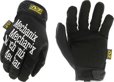
Mechanix Work Gloves with Grip
The default glove for collectors who need feel and protection.
Check price on Amazon
Osprey Talon 22 Backpack
The pack to save for if you collect more than a few times a year.
Check price on Amazon
Willit UPF 50+ Sun Shirt UPF 50+
The best all-around sun shirt for rockhounding sites — light enough to collect at, dry enough to hike out in.
Check price on Amazon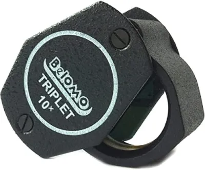
BelOMO 10x Triplet Loupe
The loupe to buy once and carry for decades.
Check price on AmazonDisclosure: Gear links may earn a commission as an Amazon Associate — at no extra cost to you. Learn more.
Access & fees
Land ownership in Douglas County is a patchwork, and it determines everything. County forest land, state forest, private timber holdings and farm ground sit side by side, often without obvious boundaries on the ground. County forest land generally permits public recreation, but rules on mineral collecting vary by county and are not the same as rules on hiking or hunting. Check with the Douglas County Forestry Department about current collecting policy before you take material. Private timber land is private regardless of whether it is fenced, and permission is required. Wisconsin state parks, including Pattison and Amnicon Falls, do not permit rock or mineral collecting. Those are viewing destinations for rift basalt, not collecting sites. Where collecting is permitted, keep it to surface material in modest personal amounts, avoid digging into stream banks, and stay off active logging operations. Park clear of forest roads so logging trucks can pass.
Land ownership in Douglas County is a patchwork, and it determines everything. County forest land, state forest, private timber holdings and farm ground sit side by side, often without obvious boundaries on the ground.
County forest land generally permits public recreation, but rules on mineral collecting vary by county and are not the same as rules on hiking or hunting. Check with the Douglas County Forestry Department about current collecting policy before you take material. Private timber land is private regardless of whether it is fenced, and permission is required.
Wisconsin state parks, including Pattison and Amnicon Falls, do not permit rock or mineral collecting. Those are viewing destinations for rift basalt, not collecting sites.
Where collecting is permitted, keep it to surface material in modest personal amounts, avoid digging into stream banks, and stay off active logging operations. Park clear of forest roads so logging trucks can pass.
Frequently asked questions
What can you find at Ounce Creek in Wisconsin?
Agate is the primary reported find, with copper, bornite, malachite, azurite, epidote, chlorite, diopside and quartz also documented from the drainage. The rock is Chengwatana Volcanic Group basalt, part of the Midcontinent Rift, which is the same volcanism behind Lake Superior agates and Keweenaw copper.
Is Ounce Creek open to the public for collecting?
It depends entirely on the parcel. Douglas County land ownership is a patchwork of county forest, state forest, private timber and farm ground. County forest collecting policy differs from hiking and hunting access, so check with the Douglas County Forestry Department, and get permission on private land.
How old is the rock at Ounce Creek?
Roughly 1.1 billion years. The Chengwatana Volcanic Group basalts erupted during the Midcontinent Rift, when the continent began to split and flooded this region with lava. Agates formed as silica filled gas cavities in the cooling flows, and glaciers later spread them widely across the upper Midwest.
Can you collect rocks at Amnicon Falls or Pattison State Park?
No. Wisconsin state parks do not permit rock or mineral collecting. Both parks are excellent for seeing Midcontinent Rift basalt in place, with waterfalls cutting directly through the flows, so treat them as geology viewing stops rather than collecting sites.
When should you visit the Ounce Creek area?
May through October, ideally in spring after runoff has scoured fresh gravel or in autumn after leaf fall opens up the cut banks. Black flies and mosquitoes are severe from late May through July, so bring repellent and a head net, and check for ticks after every trip.
What is the Midcontinent Rift?
A failed continental rift that began splitting North America roughly 1.1 billion years ago, flooding the Lake Superior region with basalt lava. It produced the native copper of Michigan's Keweenaw Peninsula and the gas cavities that became Lake Superior agates, and its rocks underlie far northwestern Wisconsin.
Where can you find copper in Wisconsin?
In the far northwest, where Midcontinent Rift basalts occur, though Wisconsin's share of the rift never produced at the scale of Michigan's Keweenaw Peninsula. Copper, bornite, malachite and azurite are reported from Douglas and Bayfield county drainages, and float copper also occurs in glacial deposits further south.
Can you collect rocks in Wisconsin state parks?
No. Wisconsin state parks do not permit rock or mineral collecting. Pattison and Amnicon Falls state parks in Douglas County are excellent places to see Midcontinent Rift basalt in place, with waterfalls cutting directly through the flows, but they are viewing destinations rather than collecting sites.
What does county forest land allow in Wisconsin?
County forest land generally permits public recreation such as hiking and hunting, but rules on mineral collecting vary by county and are not the same as general access. Check with the Douglas County Forestry Department about current collecting policy before taking material from county forest ground.
How do you identify malachite and azurite in the field?
By colour, which is unusually diagnostic: malachite is bright green and azurite deep blue, both as coatings, crusts or earthy masses on copper-bearing rock. Against grey basalt they are hard to miss, which makes them useful field indicators that you are in the right rock even when no native copper is visible.
Is northwestern Wisconsin worth searching for copper and agate?
Collectors describe it as genuine but low-density ground compared with Michigan's Keweenaw, and they consistently frame the challenge as land status rather than geology. Douglas County is a patchwork of county forest, state forest, private timber and farm land, and people report spending as much effort establishing where they can legally look as they spend looking. Those who enjoy it treat it as exploratory collecting in quiet country rather than a destination dig.
Where do people go for Lake Superior agates near here?
The recommendations split between the Lake Superior shore north of Superior and Duluth, where wave-sorted beach cobble is the classic ground, and inland gravel pits where glacial deposits concentrate material. Several collectors note that beach hunting on the Minnesota side of the lake is more productive per hour than working inland Wisconsin creeks, and that the two make a good combined trip from a base around Superior.
Explore related hubs
Report an access change
Field conditions change. If this site is closed, claimed, flooded, or the fee has changed, tell us — we update listings with community tips and desk verification.
Include the date you visited and any land-manager contact. Do not share private gate codes.
Map & location
Culture & history
The Midcontinent Rift that created this bedrock also created the copper that drew the earliest metalworking in North America: Indigenous peoples of the Lake Superior basin worked native copper for thousands of years, and the Old Copper Complex is among the oldest metal traditions in the world. Nineteenth and twentieth century prospecting followed the same rock, though Wisconsin's share of the rift never produced at Keweenaw scale. The forests here were logged heavily from the 1880s, and the county forest system that now covers much of Douglas County grew out of the cutover land that followed.
Conservation
This is working forest and private land, and collector access depends on not causing problems for the owners and operators who use it. Surface collect rather than dig, particularly along stream banks, where disturbance sends sediment into cold-water trout habitat. Take modest amounts, pack out everything, park clear of forest roads, and leave gates as you found them. Do not collect in Wisconsin state parks, where it is prohibited, and treat unmarked land as private until you confirm otherwise.
Sources & updates
Official land managers cited on this page
Always confirm current rules, closures, and fees on the agency site before visiting.
Spotted outdated access, fees, or safety info? Use Report an access change on this page or send a correction with the page URL — we review every submission.