
Succor Creek Agate Beds
Rockhounding site in Nyssa, Oregon · Agate & Jasper
Succor Creek Agate Beds is a agate rockhounding site near Nyssa, OR. Free. Best season: April through June and September through October.
Typical season: April through June and September through October
About Succor Creek Agate Beds
Succor Creek State Natural Area lies in a deep, rocky canyon in the Owyhee country of far eastern Oregon, close to the Idaho line, and Oregon State Parks describes it plainly as a remote haven for rock hounds and wildlife watchers. It is one of the premier thunderegg collecting areas in the United States, in a state that made the thunderegg its official rock in 1965.
The geology is Miocene volcanism. Succor Creek has cut through rhyolitic ash and lava of the Owyhee volcanic field, exposing the beds in cross section, and thundereggs formed as spherulites in that ash before groundwater filled their cavities with agate, jasper and chalcedony. Owyhee jasper and moss agate come from the same sequence.
What makes the site unusual administratively is that it is state park land where collecting is allowed. Oregon State Parks generally prohibits rock collecting to preserve natural resources, and Succor Creek is the exception: limited souvenir collecting by rock hounds is permitted. That word limited matters, and it is the difference between the state natural area and the Bureau of Land Management ground around it.
Key facts
Structured details for trip planning — verify access and fees with the land manager before you visit.
- Specimen type
- Agate
- Primary specimens
- Thunderegg, Owyhee Jasper, Moss Agate, Chalcedony, Petrified Wood
- Fee status
- Free
- Nearest town
- Nyssa
- State
- Oregon
- Coordinates
- 43.24000, -117.15000
- Best season
- April through June and September through October. Summer heat in the Owyhee is severe and winter closes the canyon road
- Access difficulty
- Moderate to difficult, mostly because of access. The canyon road is rough gravel and remote, and collecting means working loose ash slopes
- Collecting hazards
- Unstable terrain
- Camping
- Primitive campground in the canyon with vault toilets and no water. Dispersed camping on surrounding BLM land
- Land manager
- Bureau of Land Management
- Activities
- Surface searching and light digging for thundereggs and agate, hiking, canyon viewing, wildlife watching
- Facilities
- Vault toilets, primitive camping, picnicking and hiking. No water, no power, no cell service
- Last updated
- 2026-09-15
What to pack for Succor Creek Agate Beds
Gear we compare for agate & jasper trips like this one — tools, safety, and the hike in.



Disclosure: Gear links may earn a commission as an Amazon Associate — at no extra cost to you. Learn more.
The experience
- Best time to visitApril through June and September through October. Summer heat in the Owyhee is severe and winter closes the canyon road
- AccessModerate to difficult, mostly because of access. The canyon road is rough gravel and remote, and collecting means working loose ash slopes
- FacilitiesVault toilets, primitive camping, picnicking and hiking. No water, no power, no cell service
- Camping nearbyPrimitive campground in the canyon with vault toilets and no water. Dispersed camping on surrounding BLM land
Highlights & features
- One of the premier thunderegg collecting areas in the United States, in a dramatic rhyolite canyon
- Oregon State Parks permits limited souvenir collecting here, an exception to the usual state park ban
- Owyhee jasper and moss agate occur alongside the thundereggs
- The canyon walls are a striking geological exhibit in their own right
- The land was obtained from the Bureau of Land Management between 1966 and 1969
- Succor Creek cuts through Miocene rhyolitic ash and lava of the Owyhee volcanic field
- Thundereggs formed as spherulites in that ash and were filled with agate, jasper and chalcedony
- The canyon exposes the beds in cross section, so you can see the horizon the eggs weather out of
How to get there
Succor Creek State Natural Area is on Succor Creek Road in Malheur County, far eastern Oregon, reached from Oregon Highway 201 between Adrian and Jordan Valley, or from the Idaho side near Homedale and Marsing. The canyon road is gravel, rough in places, narrow, and drops steeply into the canyon. It is generally passable for a passenger car in dry conditions but demands care, and it is not maintained for winter travel. Trailers and large RVs are a poor idea. There is no fuel, water, food or cell service anywhere near the canyon. Nyssa, Adrian and Homedale are the nearest supply points. Carry a full-size spare, extra fuel and more water than you plan to drink. Call 541-869-2365 for current road status before travelling.
Succor Creek State Natural Area is on Succor Creek Road in Malheur County, far eastern Oregon, reached from Oregon Highway 201 between Adrian and Jordan Valley, or from the Idaho side near Homedale and Marsing.
The canyon road is gravel, rough in places, narrow, and drops steeply into the canyon. It is generally passable for a passenger car in dry conditions but demands care, and it is not maintained for winter travel. Trailers and large RVs are a poor idea.
There is no fuel, water, food or cell service anywhere near the canyon. Nyssa, Adrian and Homedale are the nearest supply points. Carry a full-size spare, extra fuel and more water than you plan to drink. Call 541-869-2365 for current road status before travelling.
Plan your visit
Treat this as a remote desert trip with a collecting bonus rather than a quick stop. Most visitors camp, because the driving in and out eats a day by itself.
Bring a rock hammer, a small pick, a pry bar, gloves, safety glasses, buckets, sun protection, a gallon of water per person per day and everything else you will need, since nothing is available in the canyon.
Timing: April through June and September through October. Facilities: vault toilets, primitive camping, picnic and hiking areas, no water.
Inside the natural area, keep collecting to a souvenir amount, which is what the park permits. If you want to collect in volume, work the Bureau of Land Management ground outside the park boundary, where the usual BLM casual collecting rules apply. Combine the trip with other Oregon collecting areas in the Owyhee, including the jasper country toward Jordan Valley.
Things you need to take to Succor Creek Agate Beds

Mechanix Work Gloves with Grip
The default glove for collectors who need feel and protection.
Check price on Amazon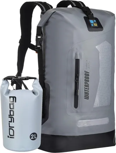
Osprey Talon 22 Backpack
The pack to save for if you collect more than a few times a year.
Check price on Amazon
Willit UPF 50+ Sun Shirt UPF 50+
The best all-around sun shirt for rockhounding sites — light enough to collect at, dry enough to hike out in.
Check price on Amazon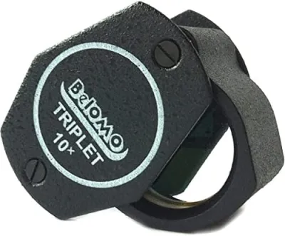
BelOMO 10x Triplet Loupe
The loupe to buy once and carry for decades.
Check price on AmazonDisclosure: Gear links may earn a commission as an Amazon Associate — at no extra cost to you. Learn more.
Access & fees
This is the section that matters most here, because the rules change at the park boundary. Inside Succor Creek State Natural Area, Oregon State Parks permits limited souvenir collecting by rock hounds. That is an explicit exception to the general Oregon state park prohibition on rock collecting, and the operative word is souvenir: a few pieces for personal keeping, not buckets. Off-road vehicles are prohibited inside the park. Outside the boundary, the surrounding land is largely Bureau of Land Management public land, where casual noncommercial collecting of rocks, minerals and petrified wood is allowed within BLM's standard limits and without a permit. Collectors intending to take real quantity should plan around BLM ground rather than the natural area. Because the boundary is not obvious in a canyon, carry a map that shows it. Whichever side you are on, use hand tools, fill your holes, keep vehicles on established roads, and pack out everything. Call the park at 541-869-2365 with questions about current rules.
This is the section that matters most here, because the rules change at the park boundary.
Inside Succor Creek State Natural Area, Oregon State Parks permits limited souvenir collecting by rock hounds. That is an explicit exception to the general Oregon state park prohibition on rock collecting, and the operative word is souvenir: a few pieces for personal keeping, not buckets. Off-road vehicles are prohibited inside the park.
Outside the boundary, the surrounding land is largely Bureau of Land Management public land, where casual noncommercial collecting of rocks, minerals and petrified wood is allowed within BLM's standard limits and without a permit. Collectors intending to take real quantity should plan around BLM ground rather than the natural area.
Because the boundary is not obvious in a canyon, carry a map that shows it. Whichever side you are on, use hand tools, fill your holes, keep vehicles on established roads, and pack out everything. Call the park at 541-869-2365 with questions about current rules.
Frequently asked questions
Can you collect rocks at Succor Creek State Natural Area?
Yes, within limits. Oregon State Parks permits limited souvenir collecting by rock hounds at Succor Creek, which is an explicit exception to the general state park prohibition on rock collecting. Keep it to a souvenir quantity for personal use; for volume collecting, work the Bureau of Land Management land outside the park boundary.
What can you find at Succor Creek?
Thundereggs are the headline find, along with Owyhee jasper, moss agate, chalcedony and petrified wood. They come from Miocene rhyolitic ash and lava of the Owyhee volcanic field, which the creek has cut through, exposing the beds the nodules weather out of.
How rough is the road into Succor Creek?
Rough gravel, narrow, and steep where it drops into the canyon. It is generally passable for a passenger car in dry weather with care, but it is not maintained for winter travel and trailers and large RVs are a poor idea. Call 541-869-2365 for current conditions before travelling.
Is there camping at Succor Creek?
Yes, a primitive campground in the canyon with vault toilets and no water. Dispersed camping is available on the surrounding Bureau of Land Management land. Bring everything, including all your drinking water, since there is nothing available in the canyon and no cell service.
When is the best time to visit Succor Creek?
April through June and September through October. Owyhee summers regularly exceed 100F with no shade in the canyon, and winter closes the road. Spring and autumn also give the best light on the canyon walls and the least risk of heat trouble on a remote road with no services.
Is Succor Creek a state park or BLM land?
Both are involved. Succor Creek State Natural Area is Oregon State Parks land, acquired between 1966 and 1969 partly through a grant from the Bureau of Land Management. The land immediately surrounding the park is BLM public land. Collecting rules differ between the two, so knowing which side of the boundary you are on matters.
What is Owyhee jasper?
A picture jasper from the Owyhee volcanic field of eastern Oregon and southwestern Idaho, prized by cabochon cutters for its landscape-like patterns in blues, browns and creams. It comes from the same Miocene volcanic sequence that produces the thundereggs, and it is one of the reasons collectors travel to this remote corner of Oregon.
How far is Succor Creek from Boise?
Roughly two hours, approaching from the Idaho side through Homedale and Marsing onto Succor Creek Road, which makes Boise the most practical base for a trip. From the Oregon side, Nyssa and Adrian are the nearest supply points on Highway 201. Either way, the last stretch is remote gravel with no services.
Are off-road vehicles allowed at Succor Creek?
Not inside the state natural area, where off-road vehicle use is prohibited as in Oregon state parks generally. The rules differ on the Bureau of Land Management land outside the park, where designated routes and area rules apply. Check current BLM travel management maps rather than assuming open access.
Is Succor Creek good for camping and stargazing?
Yes to both. The primitive campground sits in the canyon with vault toilets and no water, and the Owyhee has almost no light pollution, which makes it one of the darker skies in the lower 48. Bring all your own water and be prepared for cold nights even after hot days.
How much can you actually take from Succor Creek without breaking the rules?
This is the question that comes up most, and the honest answer is that Oregon State Parks says limited souvenir collecting rather than giving a number. Collectors who discuss it generally interpret that as a few pieces you could carry in a pocket or a small bag, not a bucket, and they point people wanting quantity to the surrounding Bureau of Land Management ground where the standard casual collecting limits apply. If the amount you want would look like a haul, you are on the wrong side of the boundary.
Is the drive into the Owyhee worth it for a weekend?
Trip reports generally say yes for people who camp and treat the whole Owyhee as the destination, and no for anyone hoping to drop in for an afternoon. The canyon road eats time, there are no services, and the collecting rewards patience rather than speed. What people consistently describe as the payoff is the combination: thundereggs and Owyhee jasper, a dramatic rhyolite canyon, almost no other visitors, and some of the darkest night skies in the country.
Explore related hubs
Report an access change
Field conditions change. If this site is closed, claimed, flooded, or the fee has changed, tell us — we update listings with community tips and desk verification.
Include the date you visited and any land-manager contact. Do not share private gate codes.
Map & location
Culture & history
The name Succor Creek is said to refer to relief found by early travellers in the Snake River Basin, and the corridor was part of the overland routes into eastern Oregon. The state acquired the land between 1966 and 1969 through a grant from the Bureau of Land Management, together with purchase and litigation involving private owners. The Owyhee country takes its name from a corruption of Hawaii, after Hawaiian trappers working for the Pacific Fur Company disappeared in the drainage in 1819. It remains one of the least populated regions in the lower 48, and the thunderegg beds have been collected by Oregon rockhounds since the mid-twentieth century.
Conservation
The collecting exception at Succor Creek exists on the understanding that visitors keep to souvenir quantities. Taking volume out of a state natural area is what gets exceptions revoked, so if you want more, go to BLM ground outside the boundary. Fill any hole you dig, work loose material rather than cutting into the canyon slopes, and keep vehicles on the road, since off-road travel is prohibited in the park and scars desert soil for decades anywhere in the Owyhee. Pack out everything including food waste, use the vault toilets, and take particular care with fire in a landscape where a single spark can run for miles.
Sources & updates
Official land managers cited on this page
Always confirm current rules, closures, and fees on the agency site before visiting.
Spotted outdated access, fees, or safety info? Use Report an access change on this page or send a correction with the page URL — we review every submission.