
Turtle Mountain Agate
Rockhounding site in Bottineau, North Dakota · Agate & Jasper
Turtle Mountain Agate is a agate rockhounding site near Bottineau, ND. Fee varies. Best season: May through October.
Typical season: May through October
About Turtle Mountain Agate
The Turtle Mountains straddle the North Dakota and Manitoba border in Bottineau and Rolette counties, and they are an oddity: a forested, lake-dotted upland rising several hundred feet above prairie that runs flat in every direction. They are not a bedrock range. They are a glacial upland, built of till and outwash left as the Laurentide Ice Sheet stagnated and melted.
That origin is the key to collecting here. Every agate, jasper and chalcedony pebble in the Turtle Mountains arrived as an erratic, carried from source rock hundreds of miles to the north and east. Granite and gneiss erratics from the Canadian Shield sit in the same gravel and are the clearest evidence of where the load came from. The kettle lakes scattered across the upland formed where blocks of stranded ice melted out of the till.
Practically, that means searching till rather than outcrop: gravel road ditches, eroded cut banks, lake beaches and, where you can arrange access, gravel pits. Material tends to be smaller and more battered than lake-polished agate, as till material always is. Access is the limiting factor, since much of the upland is private and North Dakota state parks restrict removing natural features.
Key facts
Structured details for trip planning — verify access and fees with the land manager before you visit.
- Specimen type
- Agate
- Primary specimens
- Agate, Chalcedony, Jasper, Granite Erratics, Petrified Wood
- Fee status
- Fee varies
- Nearest town
- Bottineau
- State
- North Dakota
- Coordinates
- 48.85000, -100.45000
- Best season
- May through October. Spring after frost heave and autumn after leaf fall both expose fresh gravel
- Access difficulty
- Easy. Gentle forested hills, lake shores and gravel road ditches, with access being the only real obstacle
- Collecting hazards
- See safety tips
- Camping
- Lake Metigoshe State Park has camping; note that state park rules restrict removing natural features
- Land manager
- State park / recreation agency
- Activities
- Searching road ditch gravel, lake beaches and eroded cut banks for glacially transported agate and jasper
- Facilities
- Lake Metigoshe State Park and the Turtle Mountain State Forest have facilities; Bottineau and Rolla have services
- Last updated
- 2026-09-15
What to pack for Turtle Mountain Agate
Gear we compare for agate & jasper trips like this one — tools, safety, and the hike in.



Disclosure: Gear links may earn a commission as an Amazon Associate — at no extra cost to you. Learn more.
The experience
- Best time to visitMay through October. Spring after frost heave and autumn after leaf fall both expose fresh gravel
- AccessEasy. Gentle forested hills, lake shores and gravel road ditches, with access being the only real obstacle
- FacilitiesLake Metigoshe State Park and the Turtle Mountain State Forest have facilities; Bottineau and Rolla have services
- Camping nearbyLake Metigoshe State Park has camping; note that state park rules restrict removing natural features
Highlights & features
- A forested upland rising above the surrounding prairie, unusual in North Dakota
- Agates arrive entirely as glacial erratics, carried from Canadian Shield sources to the north and east
- Lake Metigoshe and the surrounding lakes give shoreline gravel to search
- The International Peace Garden sits on the border at the eastern end of the range
- Turtle Mountain State Forest is one of very few forested public tracts in the state
- The Turtle Mountains are a glacial upland of till and outwash rather than a bedrock range, which is why the rock in them came from elsewhere
- Agate, jasper and chalcedony here were transported by the Laurentide Ice Sheet from sources hundreds of miles away
- Granite and gneiss erratics from the Canadian Shield occur in the same gravel and are the clearest evidence of transport
How to get there
The Turtle Mountains lie north of Bottineau in north-central North Dakota, reached on US Highway 281 and North Dakota Highway 5, with the border ports at Dunseith and the International Peace Garden at the eastern end. Bottineau and Rolla are the practical bases, both small towns with fuel and food. Minot, about an hour and a half southwest, is the nearest city with full services. The upland is crossed by a grid of gravel county and forest roads, easy in dry weather but slick after rain and drifted shut in winter. Lake Metigoshe State Park and the Turtle Mountain State Forest give signed public access points, and the roads to them are paved or well maintained.
The Turtle Mountains lie north of Bottineau in north-central North Dakota, reached on US Highway 281 and North Dakota Highway 5, with the border ports at Dunseith and the International Peace Garden at the eastern end.
Bottineau and Rolla are the practical bases, both small towns with fuel and food. Minot, about an hour and a half southwest, is the nearest city with full services.
The upland is crossed by a grid of gravel county and forest roads, easy in dry weather but slick after rain and drifted shut in winter. Lake Metigoshe State Park and the Turtle Mountain State Forest give signed public access points, and the roads to them are paved or well maintained.
Plan your visit
Plan a day and structure it around where you can legally look.
Bring a spray bottle, polarised sunglasses, a bag, a small hand rake and boots. Wetting gravel is essential in till country, where dry pebbles all look the same regardless of what they are.
Timing: May through October, best in spring after frost heave and autumn after leaf fall. Facilities: Lake Metigoshe State Park and Turtle Mountain State Forest; services in Bottineau and Rolla.
Road ditch gravel along the county grid is public right of way and is the most straightforward ground. Lake beaches give a sorted alternative. State forest land offers walking access, though collecting rules on state land should be confirmed. Note that Lake Metigoshe State Park restricts removing natural features, so treat it as camping and scenery rather than a collecting site. See other North Dakota collecting areas.
Things you need to take to Turtle Mountain Agate

Mechanix Work Gloves with Grip
The default glove for collectors who need feel and protection.
Check price on Amazon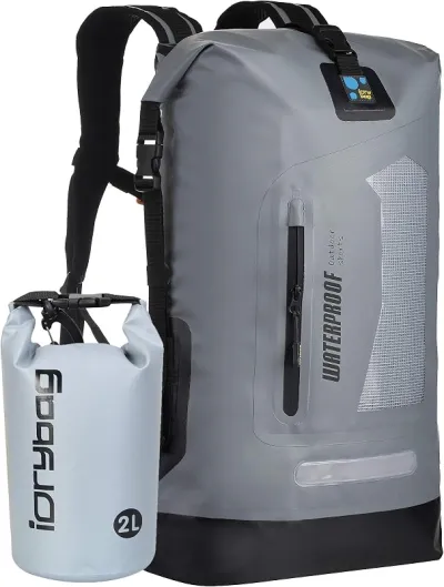
Osprey Talon 22 Backpack
The pack to save for if you collect more than a few times a year.
Check price on Amazon
Willit UPF 50+ Sun Shirt UPF 50+
The best all-around sun shirt for rockhounding sites — light enough to collect at, dry enough to hike out in.
Check price on Amazon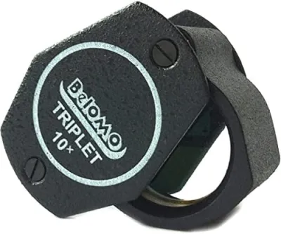
BelOMO 10x Triplet Loupe
The loupe to buy once and carry for decades.
Check price on AmazonDisclosure: Gear links may earn a commission as an Amazon Associate — at no extra cost to you. Learn more.
Access & fees
Land in the Turtle Mountains is a patchwork, and the categories carry different rules. North Dakota state parks, including Lake Metigoshe, restrict removing natural features. Treat them as bases rather than collecting grounds. Turtle Mountain State Forest is public land managed by the North Dakota Forest Service, and public recreation is allowed. Mineral collecting rules on state forest land are not the same as hiking access, so confirm with the managing agency before taking material. Much of the upland is private, and North Dakota has specific rules on land posting and on what constitutes permission. Ask the landowner, and do not rely on the absence of a sign. The Turtle Mountain Band of Chippewa Indians reservation lies immediately south of the range in Rolette County. That is tribal land with its own rules and is not open to casual collecting. Road ditches along county gravel roads are public right of way for travel, and picking up loose surface gravel there is generally accepted, but park fully off the travelled way and do not dig.
Land in the Turtle Mountains is a patchwork, and the categories carry different rules.
North Dakota state parks, including Lake Metigoshe, restrict removing natural features. Treat them as bases rather than collecting grounds.
Turtle Mountain State Forest is public land managed by the North Dakota Forest Service, and public recreation is allowed. Mineral collecting rules on state forest land are not the same as hiking access, so confirm with the managing agency before taking material.
Much of the upland is private, and North Dakota has specific rules on land posting and on what constitutes permission. Ask the landowner, and do not rely on the absence of a sign.
The Turtle Mountain Band of Chippewa Indians reservation lies immediately south of the range in Rolette County. That is tribal land with its own rules and is not open to casual collecting.
Road ditches along county gravel roads are public right of way for travel, and picking up loose surface gravel there is generally accepted, but park fully off the travelled way and do not dig.
Frequently asked questions
Are there agates in the Turtle Mountains of North Dakota?
Yes, as glacial erratics rather than as local bedrock material. The Turtle Mountains are a glacial upland of till and outwash, so the agate, jasper and chalcedony found there were carried by the Laurentide Ice Sheet from sources hundreds of miles to the north and east.
Can you collect rocks at Lake Metigoshe State Park?
No. North Dakota state parks restrict removing natural features, so Lake Metigoshe works as a camping and scenery base rather than a collecting site. Road ditches along county gravel roads and permitted private ground are the practical places to search in the surrounding upland.
Where do you look for agates in till country?
Gravel road ditches, eroded cut banks, lake beaches and gravel pits, since the material is spread through glacial deposits rather than concentrated in an outcrop. Wetting the gravel is essential, because dry till pebbles all look alike and an agate is invisible until it is wet.
Why are the Turtle Mountains forested when the rest of North Dakota is prairie?
Because the glacial upland rises several hundred feet above the surrounding plain, which changes the local climate enough to support aspen and oak woodland and the lakes between them. It is a glacial landform rather than a bedrock range, built from till and outwash left as the ice sheet stagnated.
When is the best time to search the Turtle Mountains?
May through October, with spring after frost heave and autumn after leaf fall being the two best windows. Frost lifts fresh gravel to the surface and leaf-off conditions open up cut banks and ditches. Winter closes the gravel road grid with drifting snow.
What rocks can you find in North Dakota?
Petrified wood, the state fossil, from Paleocene sediments in the western badlands; agate, jasper and chalcedony as glacial erratics across the eastern and central parts of the state; and fossils from the Cretaceous and Paleocene sequences. Much of it sits on private land, so access is the recurring theme.
What is the International Peace Garden?
A formal garden and commemorative site established in 1932 on the Canada and United States border at the eastern end of the Turtle Mountains, marking the long undefended boundary between the two countries. It is the best known landmark in the area and sits partly in North Dakota and partly in Manitoba.
Is road ditch collecting legal in North Dakota?
County road right of way is public for travel, and picking up loose surface gravel is generally accepted, but the rules are not uniform and digging in a ditch is not appropriate since it is drainage infrastructure. Park fully off the travelled way, keep to loose material, and check local guidance if in doubt.
How did agates get to North Dakota?
By ice. The Laurentide Ice Sheet advanced across the Canadian Shield and the Lake Superior basin, picking up agate, jasper, granite and gneiss, then deposited that load as till across the Dakotas and the upper Midwest. Everything collectible in the Turtle Mountains arrived that way.
Is the Turtle Mountain reservation open to visitors?
The Turtle Mountain Band of Chippewa Indians reservation lies immediately south of the range in Rolette County. It is tribal land with its own rules and is not open to casual rock collecting. Visitors should treat it as they would any sovereign jurisdiction and seek permission for any activity beyond travel on public roads.
Is North Dakota worth a dedicated rockhounding trip?
The honest view in discussions is that North Dakota rewards people already in the region more than it justifies a long drive. The western badlands and their petrified wood get the strongest recommendations, with glacial agate hunting in the east and centre described as pleasant but low-yield compared with Minnesota or Lake Superior. What people consistently flag is that access, not geology, is the binding constraint, since so much of the state is private agricultural land.
How do you ask for permission to collect on farm or ranch land?
The approach collectors describe as working in the northern plains is the same one hunters use: find the landowner through the county office or a neighbour, ask in person or by phone rather than at the gate, say exactly what you want to do and where, offer to stay out of fields and close gates, and accept a no without pushing. People report that a request to walk a ditch or a pasture edge for rocks is far more likely to be granted than one that involves digging or driving onto ground.
Explore related hubs
Report an access change
Field conditions change. If this site is closed, claimed, flooded, or the fee has changed, tell us — we update listings with community tips and desk verification.
Include the date you visited and any land-manager contact. Do not share private gate codes.
Map & location
Culture & history
The Turtle Mountains are the homeland of the Turtle Mountain Band of Chippewa Indians, whose reservation lies immediately south of the range, and Métis communities have deep roots here on both sides of the international border. The International Peace Garden, established in 1932 on the border at the eastern end of the range, commemorates the long undefended boundary between Canada and the United States and is the best known landmark in the area. The upland's forest and lakes made it a refuge and a resource in a region otherwise given over to prairie agriculture.
Conservation
Most of this upland is private working land, and collector access depends on the same courtesy that governs hunting access in North Dakota: ask, respect posting, close gates and leave no trace. Do not dig in road ditches, which are drainage infrastructure, and stick to loose surface material there. Stay out of state park collecting entirely. Avoid driving on soft gravel roads after rain, where a single vehicle can rut a road for a season. Pack out all litter and respect the reservation boundary and the international border absolutely.
Sources & updates
Official land managers cited on this page
Always confirm current rules, closures, and fees on the agency site before visiting.
Spotted outdated access, fees, or safety info? Use Report an access change on this page or send a correction with the page URL — we review every submission.