
Lake Superior Agate Beaches Wisconsin
Rockhounding site in Bayfield, Wisconsin · Agate & Jasper
Lake Superior Agate Beaches Wisconsin is a agate rockhounding site near Bayfield, WI. Fee varies. Best season: Late spring through autumn, and specifically in the days after a strong northerly blow has rearranged the cobble.
Typical season: Late spring through autumn, and specifically in the days after a strong northerly blow has rearranged the cobble
About Lake Superior Agate Beaches Wisconsin
Wisconsin has only a short reach of Lake Superior coastline, wrapping Chequamegon Bay and the Bayfield peninsula opposite the Apostle Islands, but it is genuine agate country and it sees a fraction of the traffic that Minnesota's Highway 61 beaches get on a summer weekend.
The situation here differs from the North Shore in one important respect. The bedrock along this coast is largely Bayfield Group sandstone, a soft red sedimentary rock that produced the sea caves and cliffs the region is known for. It is not agate-bearing. The agates on these beaches arrived by other means: eroded from Midcontinent Rift basalt elsewhere in the basin and delivered here by glacial ice and by the lake itself. Occasionally native copper from the same rift volcanism shows up as drift material.
That makes beach selection a question of where the lake concentrates cobble rather than where the cliffs are agate-bearing. Sheltered Chequamegon Bay sorts material differently from the exposed outer coast, and the days after a strong northerly blow are when either is worth walking. Before you start, establish whether you are standing inside Apostle Islands National Lakeshore, where collecting is prohibited.
Key facts
Structured details for trip planning — verify access and fees with the land manager before you visit.
- Specimen type
- Agate
- Primary specimens
- Lake Superior Agate, Jasper, Quartz, Basalt, Copper
- Fee status
- Fee varies
- Nearest town
- Bayfield
- State
- Wisconsin
- Coordinates
- 46.81000, -90.81000
- Best season
- Late spring through autumn, and specifically in the days after a strong northerly blow has rearranged the cobble
- Access difficulty
- Easy walking on beaches, with the caveat that Wisconsin's share of the shore has fewer cobble beaches than Minnesota's
- Parking
- Roadside / pull-off
- Collecting hazards
- Access restrictions
- Camping
- County, state and private campgrounds operate around Chequamegon Bay and the Bayfield peninsula
- Land manager
- National Park Service
- Activities
- Beachcombing cobble and gravel beaches for agates, jasper and drift copper
- Facilities
- Vary by beach. Bayfield, Washburn and Ashland have full services and lake access
- Last updated
- 2026-09-15
What to pack for Lake Superior Agate Beaches Wisconsin
Gear we compare for agate & jasper trips like this one — tools, safety, and the hike in.



Disclosure: Gear links may earn a commission as an Amazon Associate — at no extra cost to you. Learn more.
The experience
- Best time to visitLate spring through autumn, and specifically in the days after a strong northerly blow has rearranged the cobble
- AccessEasy walking on beaches, with the caveat that Wisconsin's share of the shore has fewer cobble beaches than Minnesota's
- FacilitiesVary by beach. Bayfield, Washburn and Ashland have full services and lake access
- Camping nearbyCounty, state and private campgrounds operate around Chequamegon Bay and the Bayfield peninsula
Highlights & features
- Wisconsin's only Lake Superior coastline, wrapping Chequamegon Bay and the Bayfield peninsula
- Agates arrive both by direct erosion of rift basalt and by glacial transport
- Drift copper occasionally turns up on these beaches, a nod to the Keweenaw across the lake
- The Apostle Islands sea caves and red sandstone cliffs are the geological headline of this coast
- Less picked over than Minnesota's Highway 61 beaches on a summer weekend
- The bedrock here is largely Bayfield Group sandstone, a soft red sedimentary rock quite unlike the North Shore basalt
- That means most agates on these beaches were delivered by ice and waves rather than eroded from cliffs behind them
- Chequamegon Bay's sheltered water sorts beach material differently from the exposed outer coast
How to get there
Wisconsin Highway 13 runs the Bayfield peninsula from Ashland around through Washburn, Bayfield, Cornucopia and Port Wing, giving access to the lakeshore, and US Highway 2 approaches Ashland from the south and east. Bayfield is the ferry port for Madeline Island and the base for most Apostle Islands trips, about four and a half hours from Milwaukee and an hour and a half from Duluth. Ashland and Washburn sit on Chequamegon Bay with their own lake access. All of these are paved highways suitable for any vehicle, with county and municipal beach accesses signed along the route. Some of the smaller accesses are down short gravel roads, easy in dry weather.
Wisconsin Highway 13 runs the Bayfield peninsula from Ashland around through Washburn, Bayfield, Cornucopia and Port Wing, giving access to the lakeshore, and US Highway 2 approaches Ashland from the south and east.
Bayfield is the ferry port for Madeline Island and the base for most Apostle Islands trips, about four and a half hours from Milwaukee and an hour and a half from Duluth. Ashland and Washburn sit on Chequamegon Bay with their own lake access.
All of these are paved highways suitable for any vehicle, with county and municipal beach accesses signed along the route. Some of the smaller accesses are down short gravel roads, easy in dry weather.
Plan your visit
Go after weather, not on a date. A strong northerly blow that pushes water onto this coast is what turns over the cobble and exposes new material.
Bring a bag, a small hand rake, polarised sunglasses, and something to wet stones with, since dry cobble hides everything. Layers and a windbreak matter on a shore that stays cold well into summer.
Timing: late spring through autumn, after a blow. Facilities: vary by access; full services in Bayfield, Washburn and Ashland.
Work the cobble and gravel lenses rather than sand, and check every access point's signage, because National Park Service and Wisconsin state park land interleave with county and municipal beaches here. Pair the trip with the Ounce Creek area inland in Douglas County and other Wisconsin collecting areas, and treat the sea caves at Meyers Beach as the sightseeing half of the day.
Things you need to take to Lake Superior Agate Beaches Wisconsin

Mechanix Work Gloves with Grip
The default glove for collectors who need feel and protection.
Check price on Amazon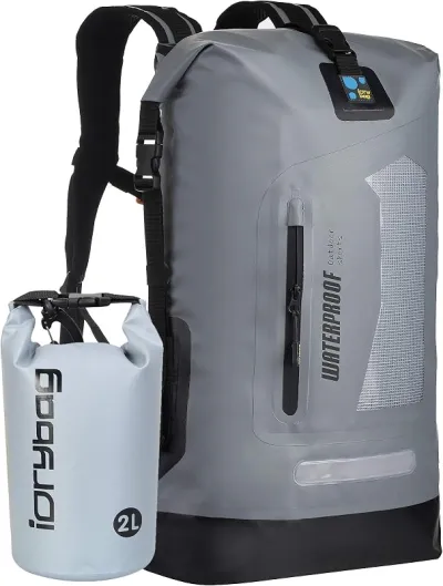
Osprey Talon 22 Backpack
The pack to save for if you collect more than a few times a year.
Check price on Amazon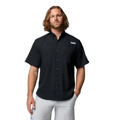
Willit UPF 50+ Sun Shirt UPF 50+
The best all-around sun shirt for rockhounding sites — light enough to collect at, dry enough to hike out in.
Check price on Amazon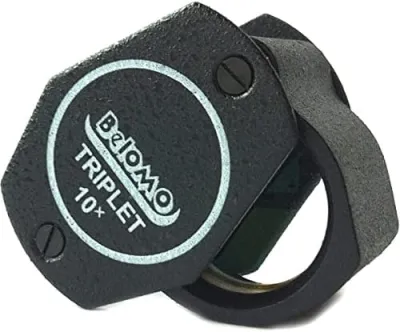
BelOMO 10x Triplet Loupe
The loupe to buy once and carry for decades.
Check price on AmazonDisclosure: Gear links may earn a commission as an Amazon Associate — at no extra cost to you. Learn more.
Access & fees
Three land categories matter on this coast and they have different rules. Apostle Islands National Lakeshore is a National Park Service unit covering the islands and stretches of mainland shore including the sea caves. Collecting rocks and minerals is prohibited in National Park Service units, so anything inside the lakeshore boundary is off limits. Wisconsin state parks and state natural areas do not permit rock or mineral collecting either. That includes the state-managed sites on and around the peninsula. County and municipal beaches are the ground to work. On those, taking a modest personal amount of loose beach material is generally accepted unless posted otherwise. Private shoreline is common between public accesses and requires permission. Madeline Island and the surrounding waters include Red Cliff and Bad River Band lands and interests; tribal land has its own rules and is not open to casual collecting. When in doubt at an unsigned access, treat it as closed.
Three land categories matter on this coast and they have different rules.
Apostle Islands National Lakeshore is a National Park Service unit covering the islands and stretches of mainland shore including the sea caves. Collecting rocks and minerals is prohibited in National Park Service units, so anything inside the lakeshore boundary is off limits.
Wisconsin state parks and state natural areas do not permit rock or mineral collecting either. That includes the state-managed sites on and around the peninsula.
County and municipal beaches are the ground to work. On those, taking a modest personal amount of loose beach material is generally accepted unless posted otherwise. Private shoreline is common between public accesses and requires permission.
Madeline Island and the surrounding waters include Red Cliff and Bad River Band lands and interests; tribal land has its own rules and is not open to casual collecting. When in doubt at an unsigned access, treat it as closed.
Frequently asked questions
Can you collect agates in the Apostle Islands?
No. Apostle Islands National Lakeshore is a National Park Service unit, and collecting rocks and minerals is prohibited in National Park Service units. That covers the islands and stretches of mainland shore including the sea caves. County and municipal beaches outside the lakeshore boundary are where collecting is possible.
Are there agates on Wisconsin's Lake Superior shore?
Yes, though they arrive differently than on Minnesota's North Shore. The bedrock here is Bayfield Group sandstone rather than agate-bearing basalt, so the agates on these beaches were eroded from rift basalt elsewhere in the basin and delivered by glacial ice and by the lake.
Where can you legally collect on the Bayfield peninsula?
On county and municipal beaches, where taking a modest personal amount of loose material is generally accepted unless posted otherwise. Apostle Islands National Lakeshore, Wisconsin state parks and state natural areas are all closed to collecting, and private shoreline requires permission.
When is the best time to hunt agates on Wisconsin's Lake Superior coast?
In the days after a strong northerly blow, which turns over the cobble and exposes fresh material. Late spring through autumn covers the practical season. As everywhere on Lake Superior, recent weather matters far more than the calendar date or the specific beach you choose.
Can you find copper on Wisconsin's Lake Superior beaches?
Occasionally, as drift material. Native copper from the Midcontinent Rift, the same volcanism that produced Michigan's Keweenaw deposits, reaches these beaches now and then. It is a bonus rather than a target, and any piece should be checked against the same access rules that apply to agate.
What are the Apostle Islands sea caves made of?
Bayfield Group sandstone, a soft red sedimentary rock that the lake has carved into arches, chambers and passages along the mainland shore and the island cliffs. The same stone was quarried commercially in the nineteenth century as brownstone and shipped to cities across the Midwest.
Is Bayfield or Ashland better for beachcombing?
They offer different conditions rather than different quality. Bayfield sits on the exposed outer peninsula where the lake works cobble hard, while Ashland and Washburn are on sheltered Chequamegon Bay where material sorts more gently. Both are worth walking after a blow, and both have public accesses outside national lakeshore boundaries.
Can you visit the sea caves by kayak?
Yes, and it is the classic way to see them, though Lake Superior conditions make it a serious undertaking rather than a casual paddle. Guided trips run from Bayfield and Cornucopia. Collecting is prohibited throughout the national lakeshore, so treat a caves trip as sightseeing rather than as a collecting opportunity.
Are Wisconsin's Lake Superior beaches less picked over than Minnesota's?
Generally yes, simply because Wisconsin's share of the coastline is short and sees far fewer agate hunters than the Highway 61 corridor on a summer weekend. That advantage is partly offset by the fact that much of the most attractive shoreline lies inside Apostle Islands National Lakeshore, where collecting is not allowed.
What is the winter sea cave ice?
In cold winters the sea caves along the mainland shore become reachable on foot over lake ice and fill with ice formations, which draws large crowds when the National Park Service declares access safe. Conditions are unpredictable and have proved fatal, so the Park Service determination is the only judgement that matters.
Is Wisconsin's Lake Superior shore worth a trip if Minnesota's is nearby?
Collectors comparing the two usually describe the Wisconsin side as quieter but more constrained. The beaches see fewer hunters, which matters after a weekend of traffic on the North Shore, but a large share of the best shoreline falls inside Apostle Islands National Lakeshore where collecting is off limits. The advice people give is to go for the combination of quieter county beaches and the sandstone sea caves rather than expecting more agate per hour than Minnesota produces.
How do you know if a beach is inside the national lakeshore?
The practical advice is to check boundaries before you travel rather than relying on signage at the access, because National Park Service, state, county and private shoreline interleave along this coast and not every boundary is marked at the waterline. Collectors who have been caught out describe assuming an unsigned pull-off was county land. Treating unsigned shoreline as closed and confirming county or municipal status in advance is the approach that keeps people out of trouble.
Explore related hubs
Report an access change
Field conditions change. If this site is closed, claimed, flooded, or the fee has changed, tell us — we update listings with community tips and desk verification.
Include the date you visited and any land-manager contact. Do not share private gate codes.
Map & location
Culture & history
The Bayfield peninsula and the Apostle Islands are the homeland of the Ojibwe, and Madeline Island holds deep significance in Ojibwe history as a place of settlement and gathering. The Red Cliff and Bad River bands remain present throughout the region. Bayfield Group sandstone was quarried commercially in the nineteenth century and shipped across the Midwest as brownstone, appearing in buildings from Milwaukee to Chicago. The quarry remnants along the shore are part of the same rock that forms the sea caves, and the industry shaped the towns that now serve visitors.
Conservation
This is a short, heavily visited coastline with a National Park Service unit through the middle of it. Keep collecting to county and municipal beaches, take a modest amount, and leave the sea caves and cliffs entirely alone. Sandstone is soft and carves easily, which is why graffiti is a persistent problem here; do not add to it. Stay off dune and shoreline vegetation, give nesting birds space in spring and early summer, and pack out all litter. Respect tribal land and treat unsigned shoreline as private.
Sources & updates
Official land managers cited on this page
Always confirm current rules, closures, and fees on the agency site before visiting.
Spotted outdated access, fees, or safety info? Use Report an access change on this page or send a correction with the page URL — we review every submission.