
FossilMS
Miller Bridge Bluff, Pascagoula Formation - Campbell And Otvos (1992)
Fossil collection site in the Pensacola, Greene County, Mississippi. Environment: paralic indet.. Source: Paleobiology Database (PBDB), CC BY 4.0.
View details24 rockhounding collecting sites within about 90 miles of Hattiesburg, Mississippi.
This page lists 24 natural rockhounding sites near Hattiesburg, Mississippi, sorted by distance within about 90 miles.
Near Hattiesburg, Mississippi, our directory maps 24 natural rockhounding sites within about 90 miles of the city center — including 2 agate & jaspers and 22 fossilss. The closest mapped spot is Miller Bridge Bluff, Pascagoula Formation - Campbell And Otvos (1992) (41 mi straight-line). Distances are not drive time; open each listing for directions, fee notes, access rules, and safety context before you travel.
| Central place | Hattiesburg, Mississippi |
|---|---|
| Search radius | About 90 miles |
| Mapped spots | 24 |
| Closest listing | Miller Bridge Bluff, Pascagoula Formation - Campbell And Otvos (1992) (41 mi) |
| Specimen types | Agate & Jasper (2), Fossils (22) |
| Typical fees | 24 varies |
24 rockhounding collecting sites in Mississippi, sorted by distance from the city center. For live GPS sorting, use rockhounding sites near me.
Fossil collection site in the Pensacola, Greene County, Mississippi. Environment: paralic indet.. Source: Paleobiology Database (PBDB), CC BY 4.0.
View detailsWaynesboro is a documented mineral occurrence near MS. Reported specimens include Fossils, Petrified palm wood. Verify land access and collecting rules before visiting.
View detailsFossil collection site in the Red Bluff, Wayne County, Mississippi. Environment: offshore. Source: Paleobiology Database (PBDB), CC BY 4.0.
View detailsFossil collection site in the Chickasawhay, Wanye County, Mississippi. Environment: marine indet.. Source: Paleobiology Database (PBDB), CC BY 4.0.
View detailsFossil collection site in the Chickasawhay, Wanye County, Mississippi. Environment: marine indet.. Source: Paleobiology Database (PBDB), CC BY 4.0.
View detailsFossil collection site in the Byram, Smith County, Mississippi. Environment: offshore. Source: Paleobiology Database (PBDB), CC BY 4.0.
View detailsFossil collection site in the Chickasawhay, Wanye County, Mississippi. Environment: marine indet.. Source: Paleobiology Database (PBDB), CC BY 4.0.
View detailsFossil collection site in the Byram, Smith County, Mississippi. Environment: offshore. Source: Paleobiology Database (PBDB), CC BY 4.0.
View detailsFossil collection site in the Red Bluff, Clarke County, Mississippi. Environment: offshore. Source: Paleobiology Database (PBDB), CC BY 4.0.
View detailsFossil collection site in the Red Bluff, Wayne County, Mississippi. Environment: offshore. Source: Paleobiology Database (PBDB), CC BY 4.0.
View detailsFossil collection site, Clarke County, Mississippi. Environment: coastal indet.. Source: Paleobiology Database (PBDB), CC BY 4.0.
View details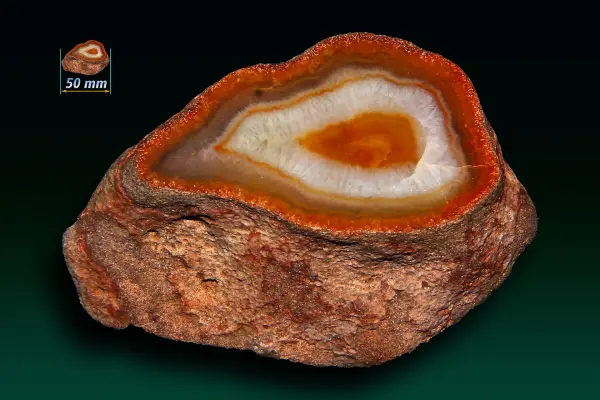
Bell Creek is a documented mineral occurrence near MS. Reported specimens include Agate. Verify land access and collecting rules before visiting.
View detailsFossil collection site in the Moodys Branch, Clarke County, Mississippi. Environment: carbonate indet.. Source: Paleobiology Database (PBDB), CC BY 4.0.
View detailsFossil collection site in the Yazoo, Jasper County, Mississippi. Environment: foreshore. Source: Paleobiology Database (PBDB), CC BY 4.0.
View detailsFossil collection site, Clark County, Mississippi. Environment: marine indet.. Source: Paleobiology Database (PBDB), CC BY 4.0.
View detailsFossil collection site in the Cook Mountain, Clarke County, Mississippi. Environment: offshore. Source: Paleobiology Database (PBDB), CC BY 4.0.
View detailsWesson is a documented mineral occurrence near MS. Reported specimens include Banded Agate, Chalcedony, Petrified wood. Verify land access and collecting rules before visiting.
View detailsFossil collection site in the Winona, Clarke County, Mississippi. Environment: marine indet.. Source: Paleobiology Database (PBDB), CC BY 4.0.
View detailsFossil collection site in the Cook Mountain, Newton County, Mississippi. Environment: offshore. Source: Paleobiology Database (PBDB), CC BY 4.0.
View detailsFossil collection site in the Cook Mountain, Mississippi. Environment: marine indet.. Source: Paleobiology Database (PBDB), CC BY 4.0.
View detailsFossil collection site in the Pensacola, Mississippi. Environment: offshore. Source: Paleobiology Database (PBDB), CC BY 4.0.
View detailsFossil collection site in the Yazoo, Scott County, Mississippi. Environment: foreshore. Source: Paleobiology Database (PBDB), CC BY 4.0.
View detailsFossil collection site in the Glendon, Rankin County, Mississippi. Environment: marine indet.. Source: Paleobiology Database (PBDB), CC BY 4.0.
View detailsFossil collection site in the Red Bluff, Mississippi. Environment: marine indet.. Source: Paleobiology Database (PBDB), CC BY 4.0.
View detailsPins within about 90 miles — open a listing for fees, access, and directions.
24 sites mapped near Hattiesburg
Browse by specimen type in Mississippi — each link opens the full state directory for that category.
Where to find agates and jasper in the U.S. — Lake Superior beaches, Ellensburg blue, Wyoming Sweetwater fields, Texas Terlingua, Mojave desert beds, and colorful chalcedony shorelines.
Trilobites, brachiopods, petrified wood, and other paleontological collecting on public land.
Hattiesburg is a practical launch point for day trips to natural rockhounding sites in Mississippi. Within about 90 miles you will find 24 mapped destinations in our directory, starting with Miller Bridge Bluff, Pascagoula Formation - Campbell And Otvos (1992) about 41 mi from the city center.
The mix spans agate & jasper, fossils — related terms searchers use include creek gravel collecting, desert washes, road cuts, and field collecting.
Every card on this page is a verified directory entry in Mississippi with map coordinates. We measure straight-line distance from the Hattiesburg city center — not driving time. A creek rockhounding site 12 miles away on forest roads can take longer than a river access point 20 miles away on a highway.
Field collecting near Hattiesburg includes informal gravel bars, dry washes, quarry faces, and developed park collecting areas. Rules, fees, and seasonal access differ by land manager. Never assume collecting is allowed without checking the listing and posted signs the day you visit.
Field conditions near Hattiesburg change after rain, snowmelt, and summer heat. Unstable slopes, heat exhaustion, loose rock, and flash floods are real risks at creek and quarry rockhounding sites — most sites have no supervision. Check weather and local advisories before you start digging.
We publish original planning copy, safety tips, and last-updated dates on each listing. See our editorial policy for sourcing standards, or contact us if access or conditions have changed.
Near Hattiesburg, Mississippi, our directory lists 24 natural rockhounding sites within about 90 miles — mainly 2 agate & jaspers and 22 fossilss. Each listing links to directions, fee notes, and safety context. Use near me on your phone for live distance sorting from your location.
This page shows 24 mapped rockhounding collecting sites within about 90 miles of Hattiesburg. The full Mississippi directory may list additional holes farther out or awaiting coordinates. Counts update as we verify new listings.
The closest mapped spot to Hattiesburg is Miller Bridge Bluff, Pascagoula Formation - Campbell And Otvos (1992) (41 mi straight-line). Open that listing for driving directions, access notes, and current fee information — unofficial holes can change without notice.
24 have variable or unverified fees. Open each spot page for current fee details.
Near Hattiesburg, documented specimen types include agate & jaspers, fossilss. A rockhounding site is a natural outcrop, wash, or creek gravel bar — not a fee dig or shop. Filter by type on the Mississippi state page or open each card for specimen and access details.
Late spring through early fall is the usual field season near Hattiesburg, but snowmelt, drought, and weekend crowds change conditions week to week. Check each listing before you drive — storms can make washes and creek banks unsafe.
Field collecting near Hattiesburg carries real risks: unstable slopes, heat, loose rock, and no rangers at most unofficial sites. Check weather and posted warnings the day you visit. Read our rockhounding safety basics guide and each listing's safety section before you dig.
Listing data last updated across spots on this page.