Missouri rockhounding features the Ste. Genevieve geode belt, Mozarkite road cuts, Old Mines galena district, and Joplin Tri-State mining heritage — use our Missouri state map for Warsaw Formation geode sites.
Missouri sits in the heart of Midwest geode country and adds Mozarkite (the state rock), galena district minerals, and Tri-State mining heritage. Rockhounding in Missouri is drive-up creek collecting for geodes and road-cut chert for lapidary hobbyists.
Goal → first stop
| What you want | Start here |
|---|---|
| Warsaw Formation geodes | Ste. Genevieve Geode Belt |
| State rock / lapidary chert | Mozarkite Road Cuts |
| Lead-zinc mineral history | Old Mines Galena District |
| Tri-State tailings context | Joplin Tri-State Mining District |
| Cross-border geode belt | Keokuk geode belt region |
| Statewide GPS map | Missouri state hub |
Missouri rockhounding map
Browse our Missouri state directory for the full rockhounding Missouri map. Sort live with near me GPS or geodes near me.
Things you need to go rockhounding in Missouri
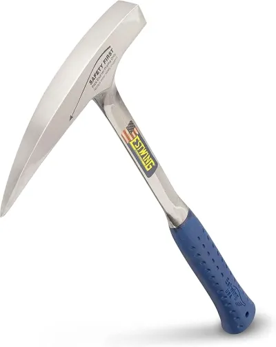
Estwing 22 oz Geological Pick
If you buy one hammer, make it this one.
Check price on Amazon
NoCry Professional Construction Knee Pads
Buy once — your knees will notice by lunch.
Check price on Amazon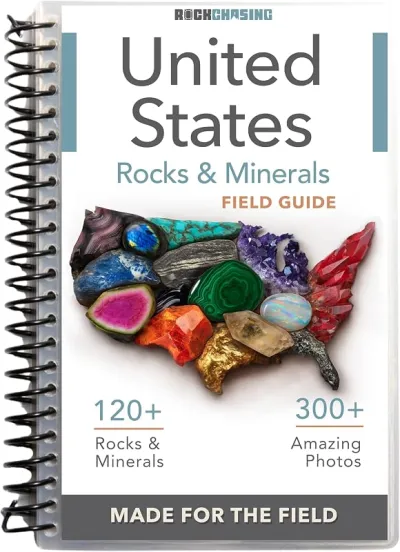
Rock Chasing US Rocks & Minerals Field Guide
The guide to clip on your pack when you do not know what you are looking at yet.
Check price on Amazon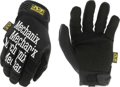
Mechanix Work Gloves with Grip
The default glove for collectors who need feel and protection.
Check price on AmazonDisclosure: Gear links may earn a commission as an Amazon Associate — at no extra cost to you. Learn more.
Ste. Genevieve geode belt
Ste. Genevieve Geode Belt anchors Missouri’s side of the Warsaw Formation — the same geologic unit that made Keokuk, Iowa famous. Creek gravels and bluff exposures yield quartz-lined nodules.
Ask permission on private farmland. Pair with Keokuk Geode Beds, the Keokuk region hub, and the geodes specimen map on a Midwest road trip.
Mozarkite road cuts
Mozarkite Road Cuts in central Missouri expose the colorful state rock in chert layers. Collectors search weathered road metal and cut banks — always prioritize safety away from active traffic.
Filter agate and jasper and the jasper specimen map for related chalcedony sites.
Old Mines galena district
Old Mines Galena District preserves lead-zinc mining history southeast of St. Louis. Mineral collectors search historic waste piles for galena, dolomite, and calcite — abandoned mine hazards demand caution and sturdy boots. Never enter underground workings.
Joplin Tri-State district
Joplin Tri-State Mining District documents the Oklahoma-Kansas-Missouri corner that supplied industrial zinc for decades. Tailings and cut exposures attract mineral collectors; respect posted reclamation areas.
Planning tips
- Spring creeks — best geode gravel exposure after rain
- Permission — private farmland dominates geode country
- St. Louis base — day trips to Ste. Genevieve and Old Mines
- Tools: hammer, bucket, glasses — essential tools guide
- Fee dig alternative: compare managed digs on dig-sites when private creeks are closed
Use near-me from Kansas City or St. Louis. Missouri connects Midwest geode belts with Ozark mineral history in one affordable collecting region.
Spots from our directory
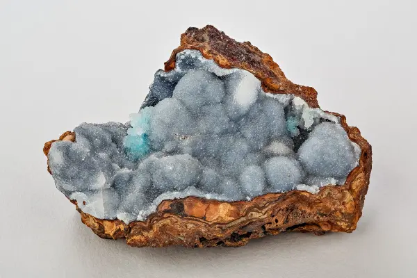
Ste. Genevieve Geode Belt
Eastern Missouri geode belt centers on Ste. Genevieve County where Warsaw Formation geodes occur in stream banks and fields.
View details
Mozarkite Road Cuts
Missouri's official state rock mozarkite, a colorful chert, occurs in Benton County road cuts and creek gravels near Lincoln.
View details
Old Mines Galena District
French colonial lead mines of Washington County Missouri still yield galena crystals in dolomite matrix in area tailings.
View detailsJoplin Tri-state Mining District
Historic Tri-State zinc-lead district around Joplin produced cabinet specimens for decades; reclamation limits but tailings remain in places.
View detailsFrequently asked questions
Can you find geodes in Missouri?
Yes. The Ste. Genevieve area sits in the Warsaw Formation geode belt shared with Iowa and Illinois. Creek and road-cut collecting requires landowner permission on much ground.
What is Mozarkite?
Mozarkite is Missouri's state rock — a colorful chert found in central Missouri road cuts and gravels, popular for lapidary work.
Is rockhounding legal in Missouri?
Public road cuts and permitted areas allow collecting in many cases. Abandoned mine waste piles may be dangerous and posted — verify access on each listing.
Where is the Tri-State mining district?
Joplin and the southwest Missouri corner hosted historic lead-zinc mining. Collectors search tailings and exposures for galena, sphalerite, and calcite specimens.
Is there a Missouri rockhounding map?
Our Missouri state hub lists geode belt, Mozarkite, and mining district sites with GPS coordinates.
How does Missouri connect to Keokuk geodes?
Ste. Genevieve sits in the same Warsaw Formation geode belt as Keokuk, Iowa. Pair Missouri listings with the Keokuk geode belt region hub on a two-state trip.
When is the best time for Missouri geodes?
Spring creeks after rain expose fresh gravel. Fall is also comfortable; summer humidity and winter ice limit long creek days.