Find rockhounding sites on our map tools — start at /maps/, use near-me GPS sorting, state hubs, specimen filters, and the directory for legal collecting locations with fees and access notes.
- Interactive maps hub
- /maps/ — national pins + state/specimen entry
- GPS distance sorting
- /near-me/ — sort cataloged sites by location
- Browse by state
- /states/ — map-style hub per state
- Filter by specimen
- /types/ + /specimens/ — geodes, quartz, gems, fossils
Searching rockhounding map or rockhounding sites usually means you want a reliable way to see where collecting is legal — not a scatter of outdated forum coordinates. Rockhounding Sites is built as a map-first directory: state hubs, specimen filters, GPS distance sorting, and individual site pages with fees, access rules, and directions.
This guide explains how each layer works and which tool to use first.
Our map layers at a glance
| Tool | URL | Best for |
|---|---|---|
| Maps hub | /maps/ | Start here — national interactive map + entry to state/specimen views |
| Near me (GPS) | /near-me/ | Closest sites from your phone or address |
| State maps | /states/ | Every listing in one state (e.g. Utah / Wyoming rockhounding map) |
| Specimen maps | /types/ · /specimens/ | Geodes, quartz, gems, fossils nationwide |
| State + type | /states/{state}/type/{type}/ | e.g. geodes in Indiana, topaz in Utah |
| Full directory | /directory/ | Search and filter all locations |
| Metro nearby | /states/{state}/{city}/nearby/ | Sites near major cities |
| Regional clusters | /regions/ | Curated multi-site trip guides |
| Dig sites catalog | /dig-sites/ | Pay-to-dig / fee mines with keep-rule notes |
Competitor sites call these “maps.” We split them into focused hubs so each page loads fast and targets one search intent — interactive overview, state browsing, near-me GPS, or specimen type.
Which rockhounding map first? Open /maps/ if you want the big picture; /near-me/ if you are leaving today; a state hub if you already know the state.
Start with near me (GPS map)
The /near-me/ page is the fastest answer to rockhounding sites near me. Tap Use My Location and the directory sorts documented sites by distance from your coordinates. Each result links to a full listing with:
- GPS coordinates and nearest towns
- Fee status (free BLM, state park entry, fee dig admission)
- Specimen types and difficulty
- Seasonal access notes
GPS sorting tells you what is closest, not what is best. A Herkimer crystal mine three hours away may beat a barren road cut ten minutes from home. Use distance as a filter, then read listing quality.
For a deeper walkthrough, see our rockhounding sites near me guide. Looking for geodes specifically? Try the geodes near me guide.
Browse by state (U.S. map index)
The /states/ index links to every state hub — for example:
- Idaho — opal fee digs and star garnet permit areas
- Tennessee — Cumberland Plateau geodes and gem mines
- Arkansas — Crater of Diamonds and the quartz belt
- Utah — Topaz Mountain and Dugway geode beds
- Indiana — Warsaw Formation geode country
Each state page lists all documented sites in that state, plus links to specimen-type subsets, metro nearby pages, and regional cluster guides. State hubs are the canonical URL for searches like “rockhounding in Tennessee” or “Idaho rockhounding map” — do not rely on thin blog duplicates for the same intent.
Filter by specimen type
National type hubs work like specimen maps:
- /types/geodes/ — Dugway, Keokuk belt, Indiana limestone
- /types/quartz-crystals/ — Herkimer, Arkansas, Carolina
- /types/gemstones/ — Topaz, sapphire, garnet localities
- /types/fossils/ — Trilobite quarries, petrified wood
- /types/turquoise-opal/ — Southwest opal and turquoise
State pages also link to state + type subsets — e.g. geodes in Indiana at /states/indiana/type/geodes/ when listings exist.
Use the full directory for search
The /directory/ is the master index — every location in one searchable grid. Filter by state, specimen category, or fee status. Use directory search when you know a place name or want to compare multiple states on one screen.
The directory pairs well with regional guides like Utah topaz & geodes or Arkansas quartz & diamonds for trip planning across several sites.
Individual site pages = map pins with context
Every listing has its own URL at /rockhounding-sites/{slug}/ — the detail behind each map pin. Site pages include:
- What specimens to expect
- Land agency and fee information
- Best season and difficulty
- FAQ blocks for common access questions
- Related nearby sites
A pin on Google Maps does not tell you if land is private, closed for season, or requires a permit. Our site pages exist to answer that before you drive.
How to search like a rockhound (workflow)
Experienced collectors use this sequence:
- Intent — near me, specific state, or specific mineral?
- Hub — open
/near-me/,/states/{state}/, or/types/{type}/ - Shortlist — open 3–5 listings that match your skill level and season
- Verify — cross-check land status on BLM or Forest Service maps
- Go — pack tools from our planning guide
For managed digs with guaranteed access, filter fee sites and read public gem mining sites. For mineral ID in the field, pair the map with our rock identification apps guide.
What our map is not
Rockhounding Sites does not replace:
- Official agency maps for land ownership and road closures
- Claim boundary data on active mining claims
- Real-time weather or road conditions in remote desert
We document collecting destinations and access notes. You still confirm rules with the managing agency the week of your trip.
Related guides
- What is rockhounding? — hobby basics and vocabulary
- Rockhounding sites near me — near-me pitfalls and land verification
- Best rockhounding sites in America — flagship destinations nationwide
A good rockhounding map is more than dots on a screen. It connects your location, your target mineral, and verified access rules — then gets you to the right listing before you load the car.
Spots from our directory
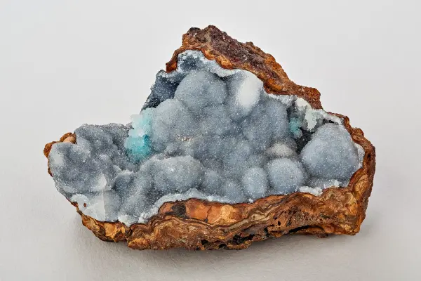
Dugway Geode Beds
Public BLM geode locality in western Juab County, Utah, where Miocene rhyolite cavities were eroded by ancient Lake Bonneville and redeposited as quartz-lined geodes in soft lakebed sediment along the Pony Express Road.
View details
Crater Of Diamonds State Park
Arkansas state park at Murfreesboro built on the eroded surface of a lamproite volcanic pipe, the only place in the world where the public can search for natural diamonds in their original source rock and keep whatever they find.
View details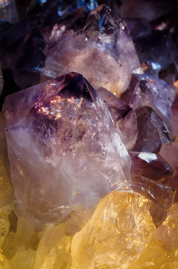
Herkimer Diamond Mines
Fee-dig quarries in the Mohawk Valley near Herkimer and Middleville, New York, where doubly terminated quartz crystals known as Herkimer diamonds are broken out of vugs in Cambrian dolomite roughly 500 million years old.
View details
Spencer Opal Mine
A family-operated opal mine in eastern Idaho offering fee digs in opal-bearing rhyolite tuff with visible opal seams.
View detailsFrequently asked questions
Is there a map of rockhounding sites?
Yes. Start at our interactive maps hub (/maps/), then use near-me GPS sorting, state hub pages, specimen maps, and the full directory. Each pin links to fees, access notes, and land-status context.
What is the best rockhounding map app?
Use a dedicated collecting directory with verified access notes rather than random social media pins. Pair our maps and near-me tools with offline topo maps and official BLM or Forest Service land-ownership layers for navigation.
How do I find rockhounding sites on a map near me?
Open our near-me page, tap Use My Location, and sites sort by driving distance. Read each listing for fees, land status, and seasonal access before you go. Metro nearby pages cover cities like Salt Lake City, Boise, and Las Vegas.
What are rockhounding sites?
Rockhounding sites are documented locations where recreational collectors can search for rocks, minerals, crystals, or fossils — on BLM land, state parks, fee dig mines, or permitted private property.
Can I filter a rockhounding map by mineral type?
Yes. Use /types/ and /specimens/ for national specimen hubs like geodes or quartz, or open a state page and follow the specimen-type links for state-specific subsets.
Is a state rockhounding map different from Google pins?
Yes. Our state hubs list cataloged sites with access notes; Google or forum pins often skip claims, park bans, and seasonal closures. Always verify land status the week you drive.